Destinations
Wisconsin outdoors
Lake Superior sea caves, quartzite bluffs over glacial lakes, and 60-plus state parks stitched together by the Ice Age Trail.
Top parks in Wisconsin
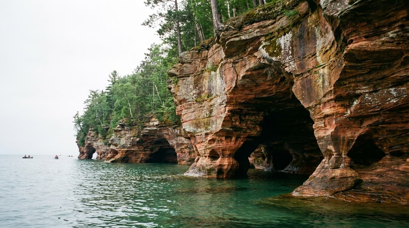
See all 108 parksApostle Islands National Lakeshore
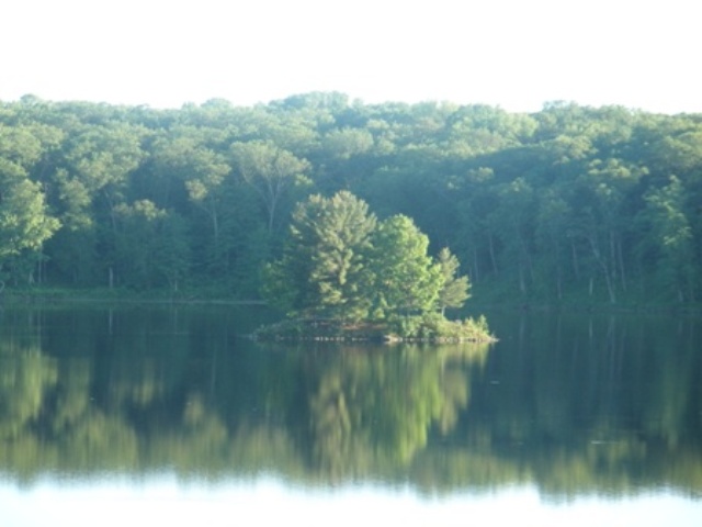
Lake Superior's island archipelago: mainland sea caves, 21 islands reached by ferry or kayak, historic lighthouses, and permit-only backcountry camping.
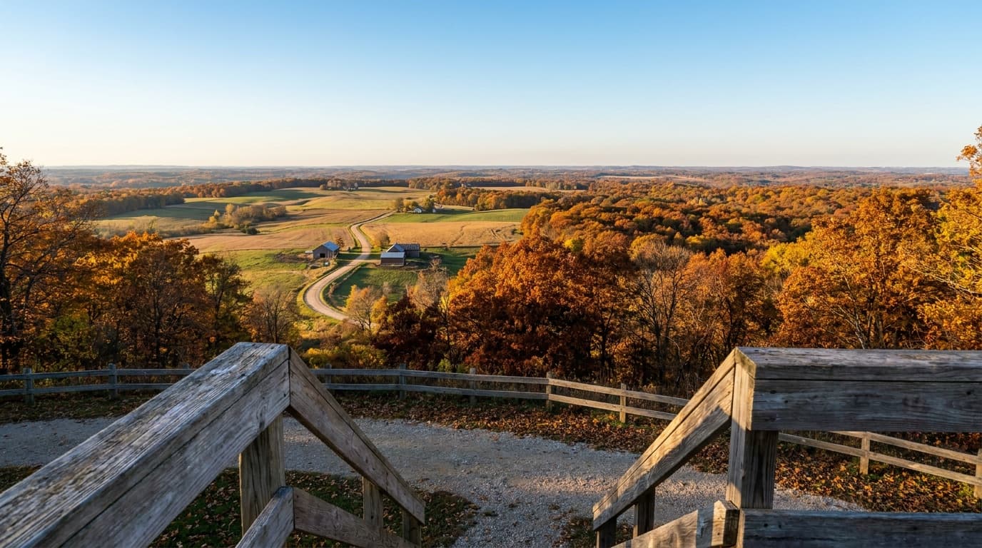
Blue Mound State Park
The highest point in southern Wisconsin: two observation towers over the Driftless Area, the only swimming pool in a Wisconsin state park, and miles of bike and ski trails.
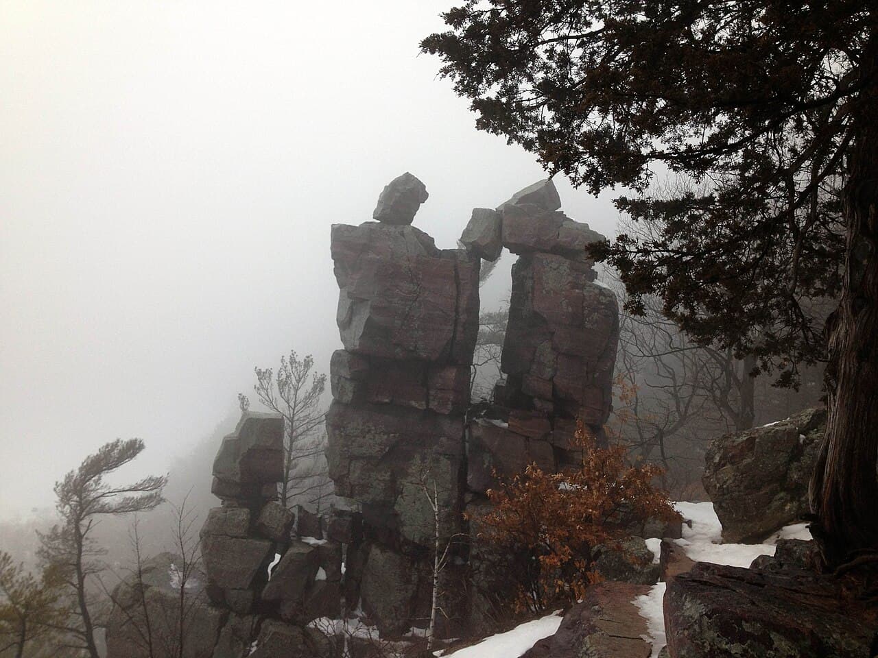
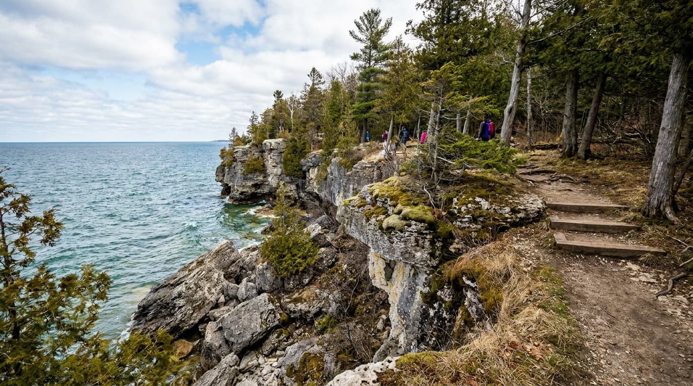
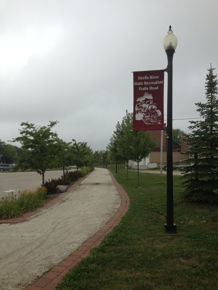
Devil's Lake State Park
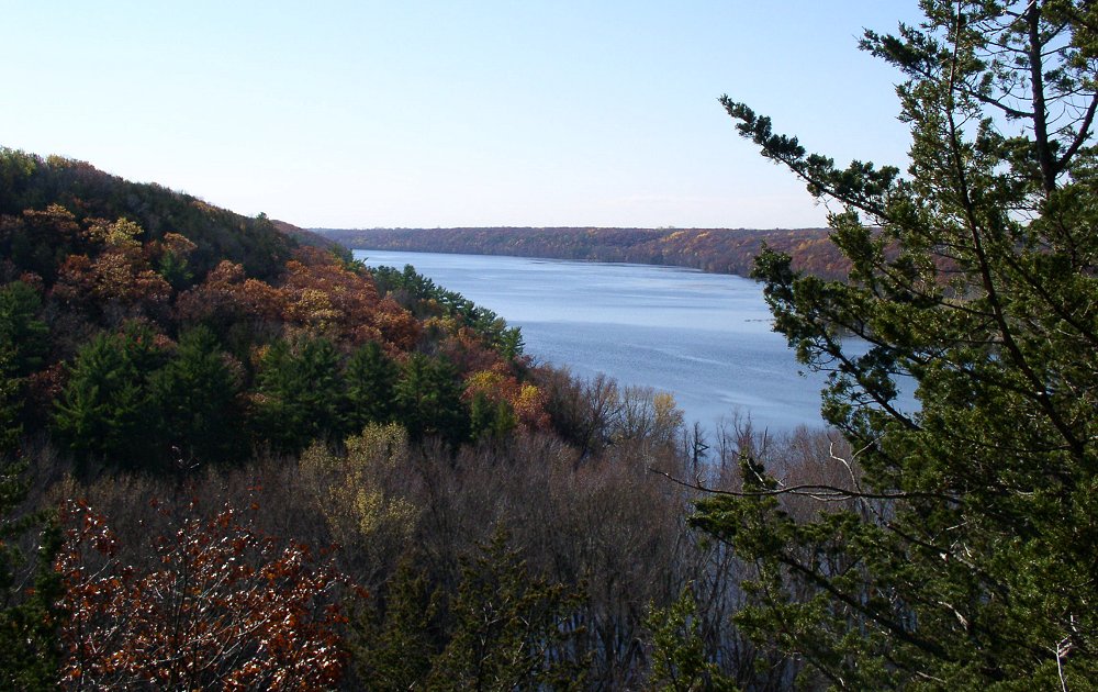
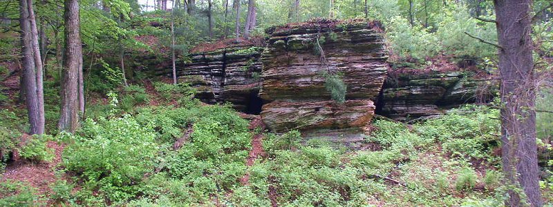
Wisconsin's cliff-and-lake classic: quartzite bluffs, Ice Age Trail miles, swimming beaches, paddling, climbing, and reservable camping.
Governor Dodge State Park
Wisconsin's Driftless-country park: two lakes, Stephens Falls, bluff and prairie trails, 40-plus miles of multi-use trail, and two large campgrounds.
Peninsula State Park
Door County's crown jewel: eight miles of Green Bay shoreline, the cliff-edge Eagle Trail, the accessible Eagle Tower, a historic lighthouse, beaches, golf, and 460-plus campsites.

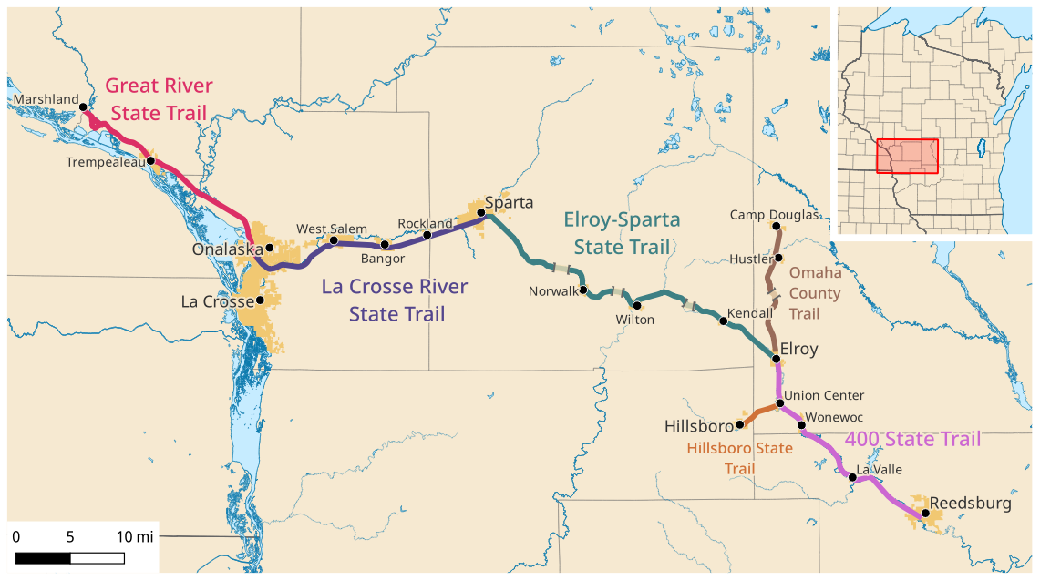
400 State Trail
The 22-mile 400 State Trail follows the Baraboo River valley from Elroy to Reedsburg, passing wetlands, wildlife, sandstone bluffs and rolling croplands.

Ahnapee State Trail
This 48-mile county-operated trail winds south from Sturgeon Bay along the Ahnapee and Kewaunee rivers through glades, farmland, prairies and wooded areas.

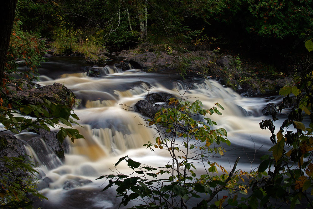
Amnicon Falls State Park
Amnicon Falls State Park features a series of waterfalls and rapids along the Amnicon River, viewable from a covered foot bridge or 2 miles of riverside trails.

Aztalan State Park
Aztalan State Park is a National Historic Landmark preserving an ancient Middle-Mississippian village with reconstructed flat-topped mounds and stockade.
Planning a Wisconsin trip
Wisconsin packs a lot of landscape between two Great Lakes. You get the dramatic stuff (500-foot quartzite bluffs, Lake Superior sea caves, glacier-carved kettles and moraines) alongside the gentle stuff (pine forests, sandy beaches, and quiet paddling lakes), and most of it sits within an easy weekend of the cities.
There is no national park here, but the Apostle Islands National Lakeshore on Lake Superior is the headline. It is 21 islands and 12 miles of mainland coast, with more lighthouses than any other site in the National Park System and the famous sandstone sea caves you paddle through in summer (and, in the rare year Lake Superior freezes solid, walk into as ice caves in February). Bayfield is the launch point for kayaks, ferries, and cruises.
For state parks, start with Devil's Lake near Baraboo, the busiest park in the state for good reason: a clear 360-acre lake ringed by towering bluffs, with climbs like the Balanced Rock and East Bluff trails that pay off in big views. Both Devil's Lake and a long ribbon of the state run along the Ice Age National Scenic Trail, which traces the edge of the last glacier across roughly a thousand miles. Door County, the peninsula reaching into Lake Michigan, adds shoreline parks, bluffs, and small-town harbors.
The sweet spot is late summer into early fall: mild days, thinner crowds, and fewer bugs, with fall color arriving up north first. Summer (highs in the 70s to low 80s F) is prime for swimming, paddling, and the sea-cave tours that run mid-June into early October. Winters are genuinely cold (single digits to 20s F up north) and turn the state into snowshoe and cross-country country.
Packing through-line: layers you can shed and add, because a sunny morning by the water can turn windy and cold fast on Lake Superior. Bring real footwear with grip for the rocky bluff trails, sun and bug protection for summer, and a warm waterproof shell any time you are near the big lakes.
Getting around Wisconsin
Most trips start at one of two airports. Milwaukee Mitchell International (MKE) is the largest, and Dane County Regional (MSN) in Madison sits closer to the central and southern parks. Both are easy interstate drives to Devil's Lake (Madison to Baraboo is roughly 45 minutes; Milwaukee about 2 hours).
The far north is the long haul. Bayfield and the Apostle Islands are about 5.5 hours from Madison and over 6 hours from Milwaukee. If the Apostle Islands are your main goal, it is often faster to fly into Duluth, Minnesota (DLH), which is under 2 hours from Bayfield with daily flights from Minneapolis and Chicago.
Once you are on the ground, a car is essential. The parks are spread out and not connected by transit. Rough drive times: Madison to Door County is about 3.5 hours; Devil's Lake to Door County is around 3 hours; and Door County to Bayfield is a long cross-state haul of roughly 5 hours, so most people pick a region (north woods and Lake Superior, or the central bluffs, or the Lake Michigan peninsula) rather than chaining them in one trip. Roads are good and well marked; the only seasonal catch is winter weather up north, where snow can slow the drive considerably.
Home-state outdoors
Think water, bluffs, forest, and shoulder-season weather.
Wisconsin is not a national park state, but it is a very real outdoor state. The best trips usually revolve around Lake Superior, the Driftless Area, Door County, the Ice Age Trail, or state-park camping weekends.
Best window
June to October, with September and October especially strong for hiking, paddling, and color.
Base logic
Bayfield for Apostle Islands, Baraboo for Devil's Lake, Door County for lakefront weekends.
Packing focus
Bug protection, rain shell, lake wind layers, camp insulation, and footwear for wet rock or sand.
Trip shape
Weekend clusters work best: one water anchor, one hiking anchor, and one weather backup.
Best first Wisconsin outdoor trip
Use Devil's Lake and the Baraboo range for big hiking payoff without leaving the southern half of the state.
Best northern trip
Base near Bayfield for Apostle Islands kayaking, shoreline hikes, waterfalls, and cooler Lake Superior weather.
State park directory
Every Wisconsin state park
A source-backed inventory layer for planning breadth. Full Kit Authority guides are marked when a park has camping detail, rules, and packing notes; the rest link straight to the official page.
108 parks
4 full guides · 88 with photos
Blue Mound State Park
State Park
Perched atop the highest point in southern Wisconsin, Blue Mound State Park offers spectacular views, a swimming pool and over 20 miles of trails.
- Camping
- Cabins
- Hiking
- Biking
Wisconsin DNR
Full guideDevil's Lake State Park
State Park
Along the Ice Age National Scenic Trail, Devil's Lake State Park offers views from 500-foot quartzite bluffs over a 360-acre lake with nearly 30 miles of trails.
- Camping
- Hiking
- Picnicking
- Swimming
Wisconsin DNR
Full guideGovernor Dodge State Park
State Park
One of the state's largest parks, Governor Dodge has over 5,000 acres of steep hills, bluffs, deep valleys, two lakes and a waterfall in the driftless area.
- Camping
- Picnicking
- Hiking
- Paddling
Wisconsin DNR
Full guidePeninsula State Park
State Park
Considered Wisconsin's most complete park, Peninsula State Park offers over 460 campsites, a summer theater, an 18-hole golf course, sand beach, bike trails, a lighthouse and eight miles of Door County shoreline.
- Camping
- Golf
- Beach
- Swimming
Wisconsin DNR
Full guide400 State Trail
State Trail
The 22-mile 400 State Trail follows the Baraboo River valley from Elroy to Reedsburg, passing wetlands, wildlife, sandstone bluffs and rolling croplands.
- Biking
- Horseback Riding
Wisconsin DNR
Official pageAhnapee State Trail
State Trail
This 48-mile county-operated trail winds south from Sturgeon Bay along the Ahnapee and Kewaunee rivers through glades, farmland, prairies and wooded areas.
- Biking
- Hiking
Wisconsin DNR
Official pageAmnicon Falls State Park
State Park
Amnicon Falls State Park features a series of waterfalls and rapids along the Amnicon River, viewable from a covered foot bridge or 2 miles of riverside trails.
- Camping
- Hiking
- Picnicking
Wisconsin DNR
Official pageAztalan State Park
State Park
Aztalan State Park is a National Historic Landmark preserving an ancient Middle-Mississippian village with reconstructed flat-topped mounds and stockade.
- Historic Site
Wisconsin DNR
Official pageBadger State Trail
State Trail
The Badger State Trail runs 40 miles between Madison and the Wisconsin-Illinois border through farmlands, woods, rolling hills, prairies and glacial topography.
- Biking
Wisconsin DNR
Official pageBelmont Mound State Park
State Park
Belmont Mound rises 1,400 feet above sea level, offering fantastic views of the area, and sits a half mile east of Wisconsin's First Capitol historic site.
Wisconsin DNR
Official pageBig Bay State Park
State Park
On Madeline Island, Big Bay State Park features sandstone bluffs along 4 miles of Lake Superior shoreline, a boardwalk, sandy beach and hiking trails.
- Camping
- Hiking
- Swimming
- Beach
Wisconsin DNR
Official pageBig Foot Beach State Park
State Park
On the shores of Lake Geneva, Big Foot Beach State Park offers 5 miles of hiking trails, a family campground, a swimming beach, and picnic and playground areas.
- Camping
- Hiking
- Swimming
- Picnicking
Wisconsin DNR
Official pageBlack River State Forest
State Forest
Two forks of the Black River flow through this 68,000-acre forest of pine and oak woods under high sandstone abutments in central Wisconsin.
- Camping
- Paddling
- Hunting
- Hiking
Wisconsin DNR
Official pageBrule River State Forest
State Forest
The Brule River State Forest offers river paddling, world-class trout fishing, wildlife viewing, 23 miles of the North Country Trail and Lake Superior shoreline.
- Camping
- Paddling
- Fishing
- Wildlife Viewing
Wisconsin DNR
Official pageBrunet Island State Park
State Park
On the Chippewa and Fisher rivers, Brunet Island State Park offers over 1,300 acres with quiet lagoons and channels excellent for canoeing and wildlife watching.
- Camping
- Paddling
- Wildlife Viewing
- Picnicking
Wisconsin DNR
Official pageBuckhorn State Park
State Park
Buckhorn State Park covers a peninsula in the Castle Rock Flowage of the Wisconsin River, with family, group and cart-in camping, a canoe trail and fishing pier.
- Camping
- Cabins
- Hunting
- Hiking
Wisconsin DNR
Official pageBuffalo River State Trail
State Trail
This west-central Wisconsin trail follows the scenic Buffalo River valley for 36 miles between Mondovi and Fairchild past farmlands, woods, hills and wetlands.
- Biking
- Horseback Riding
Wisconsin DNR
Official pageCadiz Springs State Recreation Area
State Recreation Area
Cadiz Springs is a day use area in southwest Wisconsin's driftless region with rolling hills, valleys and spring-fed streams.
- Picnicking
- Hiking
- Hunting
- Fishing
Wisconsin DNR
Official pageCapital City State Trail
State Trail
The Capital City State Trail links around and through Madison, with nine miles passing through the scenic Capital Springs State Recreation Area.
- Biking
Wisconsin DNR
Official pageCapital Springs State Recreation Area
State Recreation Area
Minutes from downtown Madison, Capital Springs State Recreation Area offers camping, hiking and skiing trails, picnicking, fishing and a Lake Waubesa boat launch.
- Camping
- Hiking
- Winter Sports
- Picnicking
Wisconsin DNR
Official pageChippewa Moraine State Recreation Area
State Recreation Area
Along the Ice Age National Scenic Trail, Chippewa Moraine State Recreation Area features kettle lakes and glacial features with an interpretive center.
- Hiking
- Winter Sports
- Backpacking
- Fishing
Wisconsin DNR
Official pageChippewa River State Trail
State Trail
This 30-mile trail extends from downtown Eau Claire south along the Chippewa River through river bottoms, prairies, sandstone bluffs and wetlands to Durand.
- Biking
Wisconsin DNR
Official pageCopper Culture State Park
State Park
Copper Culture State Park was the site of a prehistoric cemetery of the Old Copper Complex people, with a museum of artifacts and exhibits along the Oconto River.
- Hiking
- Historic Site
Wisconsin DNR
Official pageCopper Falls State Park
State Park
Ancient lava flows, deep gorges and spectacular waterfalls make Copper Falls one of Wisconsin's most scenic parks, with log buildings built by the CCC.
- Camping
- Hiking
- Biking
- Picnicking
Wisconsin DNR
Official page


Show 84 more Wisconsin parks
Coulee State Forest
State Forest
The 3,000-acre Coulee Experimental State Forest is used for forest watershed research and has many deep gulches and ravines.
- Hunting
- Winter Sports
- Hiking
- Horseback Riding
Wisconsin DNR
Official pageCouncil Grounds State Park
State Park
Along the Wisconsin River near former Native American encampment sites, Council Grounds State Park offers wooded trails, a beach area and an accessible fishing pier.
- Camping
- Hiking
- Beach
- Fishing
Wisconsin DNR
Official pageCross Plains State Park
State Park
Cross Plains State Park, west of Madison, contains an outstanding collection of glacial landforms, a meltwater-carved gorge and expansive terrain views.
- Hiking
Wisconsin DNR
Official pageDevil's River State Trail
State Trail
This scenic rail trail in Brown and Manitowoc counties passes farmlands, prairies, rivers and wetlands and features two dramatic railroad trestles.
- Biking
- Hiking
Wisconsin DNR
Official pageEisenbahn State Trail
State Trail
This 25-mile county-operated trail extends from West Bend into eastern Wisconsin countryside past the glacial Kettle Moraine State Forest landscape.
- Biking
- Hiking
Wisconsin DNR
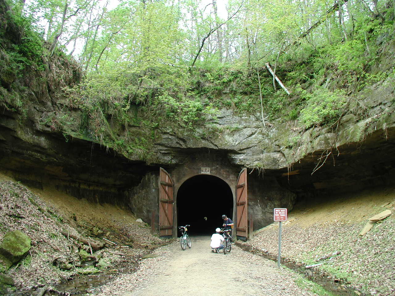
Official pageElroy-Sparta State Trail
State Trail
Considered the first rail-to-trail in the United States, the Elroy-Sparta State Trail runs 32.5 miles between Sparta and Elroy with three rock tunnels.
- Biking
- Camping
Wisconsin DNR
Official pageFischer Creek State Recreation Area
State Recreation Area
Fischer Creek has about a mile of Lake Michigan shoreline with scenic wooded bluffs rising up to 40 feet, grasslands and wetlands.
- Hiking
- Picnicking
- Wildlife Viewing
- Beach
Wisconsin DNR
Official pageFlambeau River State Forest
State Forest
The Flambeau River State Forest provides backcountry hiking, ATV and snowmobile trails, campgrounds and canoeing on the North and South forks of the river.
- Hiking
- Winter Sports
- Camping
- Hunting
Wisconsin DNR
Official pageFox River State Trail
State Trail
From downtown Green Bay, the Fox River State Trail winds along the Fox River for 25 miles on a former rail corridor with a rich history of Native American footpaths.
- Biking
- Horseback Riding
Wisconsin DNR
Official pageFriendship State Trail
State Trail
The four-mile Friendship State Trail passes through woods and scenic farmland in Calumet County between Forest Junction and Brillion.
- Biking
- Hiking
Wisconsin DNR
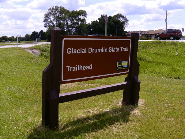
Official pageGlacial Drumlin State Trail
State Trail
This 52-mile trail stretches through farmlands and glacial topography from Cottage Grove to Waukesha, passing through 10 small towns on an abandoned rail corridor.
- Biking
- Camping
Wisconsin DNR
Official pageGovernor Knowles State Forest
State Forest
This 55-mile-long forest in northwestern Wisconsin parallels the St. Croix National Scenic Riverway across 32,500 wooded acres.
- Camping
- Paddling
- Hiking
- Horseback Riding
Wisconsin DNR
Official pageGovernor Nelson State Park
State Park
On 10,000-acre Lake Mendota within sight of the State Capitol, Governor Nelson is a day use park with a sand beach, boat launch, prairies and over 8 miles of trails.
- Beach
- Boating
- Picnicking
- Playground
Wisconsin DNR
Official pageGovernor Thompson State Park
State Park
With over 2,800 acres of woods, Governor Thompson State Park offers a campground, beach on Woods Lake, trails and 6 miles of Caldron Falls Flowage shoreline.
- Camping
- Picnicking
- Beach
- Hiking
Wisconsin DNR
Official pageGreat River State Trail
State Trail
This 24-mile trail travels through prairies and backwaters of the upper Mississippi River valley within the Mississippi Flyway, past two National Wildlife Refuges.
- Hiking
- Biking
- Winter Sports
Wisconsin DNR
Official pageHank Aaron State Trail
State Trail
Named for baseball legend Hank Aaron, this trail connects American Family Field to the Milwaukee Lake Michigan lakefront and links to famous local landmarks.
- Biking
- Hiking
Wisconsin DNR
Official pageHarrington Beach State Park
State Park
Harrington Beach State Park has more than a mile of Lake Michigan beach plus a cedar and hardwood swamp, restored wetland ponds and a limestone quarry lake.
- Camping
- Beach
- Picnicking
- Hiking
Wisconsin DNR
Official pageHartman Creek State Park
State Park
On the Chain O' Lakes, Hartman Creek State Park is a central Wisconsin gem with camping, the historic Hellestad House log cabin and four picnic areas.
- Camping
- Boating
- Swimming
- Horseback Riding
Wisconsin DNR
Official pageHavenwoods State Forest
State Forest
Havenwoods is Wisconsin's only urban state forest, featuring 237 acres of grasslands, woods and wetlands and over 6 miles of trails in the city of Milwaukee.
- Hiking
- Biking
- Wildlife Viewing
Wisconsin DNR
Official pageHeritage Hill State Park
State Park
Heritage Hill State Park is a living history outdoor museum in Green Bay featuring 24 structures from Wisconsin's past spanning 1762 to 1905.
- Historic Site
Wisconsin DNR
Official pageHigh Cliff State Park
State Park
High Cliff is the only state-owned recreation area on Lake Winnebago, named for the limestone cliff of the Niagara Escarpment along the lake's eastern shore.
- Camping
- Boating
- Picnicking
Wisconsin DNR
Official pageHoffman Hills State Recreation Area
State Recreation Area
Hoffman Hills offers 700 acres of wooded hills, wetlands and prairie with trails and a 60-foot observation tower atop one of the highest points in Dunn County.
- Hiking
- Winter Sports
Wisconsin DNR
Official pageKinnickinnic State Park
State Park
Where the St. Croix and Kinnickinnic rivers meet, Kinnickinnic State Park offers a large sandy delta, water-based recreation and 10 miles of hiking trails.
- Hiking
- Boating
- Picnicking
Wisconsin DNR
Official pageKohler-Andrae State Park
State Park
Kohler-Andrae State Park is home to majestic sand dunes, miles of golden beach and whispering pines along one of the last natural preserves on the Lake Michigan shore.
- Camping
- Beach
- Hiking
- Picnicking
Wisconsin DNR
Official pageLa Crosse River State Trail
State Trail
The 22-mile La Crosse River State Trail runs on an abandoned railroad between Sparta and La Crosse with a packed-limestone surface.
- Hiking
- Biking
- Winter Sports
Wisconsin DNR
Official pageLake Kegonsa State Park
State Park
Lake Kegonsa State Park offers recreation along a 3,200-acre lake with a swimming beach, picnic areas, a boat launch and trails through oak woodlands and prairies.
- Swimming
- Beach
- Picnicking
- Boating
Wisconsin DNR
Official pageLake Wissota State Park
State Park
Northeast of Chippewa Falls, Lake Wissota State Park offers secluded campsites, trails and a swimming beach on a 6,300-acre man-made lake.
- Camping
- Hiking
- Biking
- Horseback Riding
Wisconsin DNR
Official pageLakeshore State Park
State Park
In downtown Milwaukee, Lakeshore State Park is an urban oasis with a small beach and accessible paved trails linking to other lakefront parks and the Hank Aaron Trail.
- Beach
- Hiking
- Biking
- Boating
Wisconsin DNR
Official pageLizard Mound State Park
State Park
Lizard Mound is one of the most well-preserved Native American effigy mound sites in the nation, with 28 conical and linear mounds.
- Historic Site
- Hiking
Wisconsin DNR
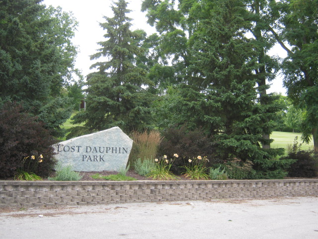
Official pageLost Dauphin State Park
State Park
Lost Dauphin State Park is a small 19-acre gem along the Fox River south of De Pere in Brown County, operated locally by the Town of Lawrence.
- Hiking
- Picnicking
Wisconsin DNR
Official pageMerrick State Park
State Park
Merrick State Park sits on the backwaters of the Mississippi River, with island campsites offering river access for mooring or fishing, 3 miles of hiking trails and two boat landings.
- Camping
- Hiking
- Fishing
- Boating
Wisconsin DNR
Official pageMilitary Ridge State Trail
State Trail
The 40-mile Military Ridge State Trail connects Dodgeville and Madison along an 1855 military route, passing agricultural lands, woods, wetlands and prairies.
- Biking
- Hiking
Wisconsin DNR
Official pageMill Bluff State Park
State Park
Part of the Ice Age National Scientific Reserve, Mill Bluff State Park offers picturesque rock formations along with campsites, picnic areas, hiking trails and a swimming pond.
- Camping
- Hiking
- Swimming
- Picnicking
Wisconsin DNR
Official pageMirror Lake State Park
State Park
Mirror Lake State Park centers on a calm lake reflecting wooded shoreline with cliffs up to 50 feet high, plus a swimming beach, wetlands, picnic areas and wooded campsites.
- Camping
- Cabins
- Hiking
- Swimming
Wisconsin DNR
Official pageMountain-Bay State Trail
State Trail
The Mountain-Bay State Trail is one of Wisconsin's longest rail-trails, running 83 miles between Rib Mountain near Wausau and Green Bay.
- Biking
- Hiking
Wisconsin DNR
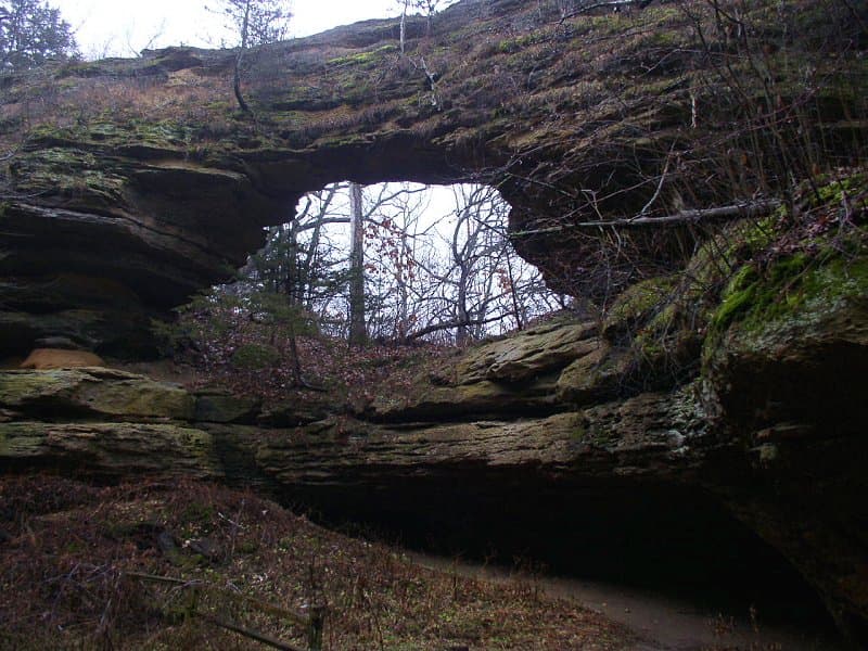
Official pageNatural Bridge State Park
State Park
Natural Bridge State Park features a sandstone arch 25 feet high by 35 feet wide created by wind and water erosion, near a rock shelter used by native people 11,000 years ago.
- Hiking
- Historic Site
Wisconsin DNR
Official pageNelson Dewey State Park
State Park
Nelson Dewey State Park overlooks the Mississippi River from a 500-foot bluff, combining history with camping, hiking and picnicking near the Dewey home and Stonefield Historic site.
- Camping
- Hiking
- Picnicking
- Historic Site
Wisconsin DNR
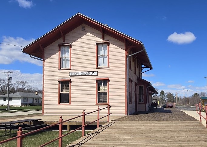
Official pageNew Glarus Woods State Park
State Park
New Glarus Woods State Park is a 435-acre park offering camping, hiking, picnicking and snowshoeing, with direct access to the Sugar River State Trail.
- Camping
- Hiking
- Picnicking
- Biking
Wisconsin DNR
Official pageNewport State Park
State Park
Newport State Park offers over 2,300 acres of forest on 11 miles of Lake Michigan shoreline with 30 miles of hiking trails, backpack camping and Dark Sky Park designation for stargazing.
- Camping
- Backpacking
- Hiking
Wisconsin DNR
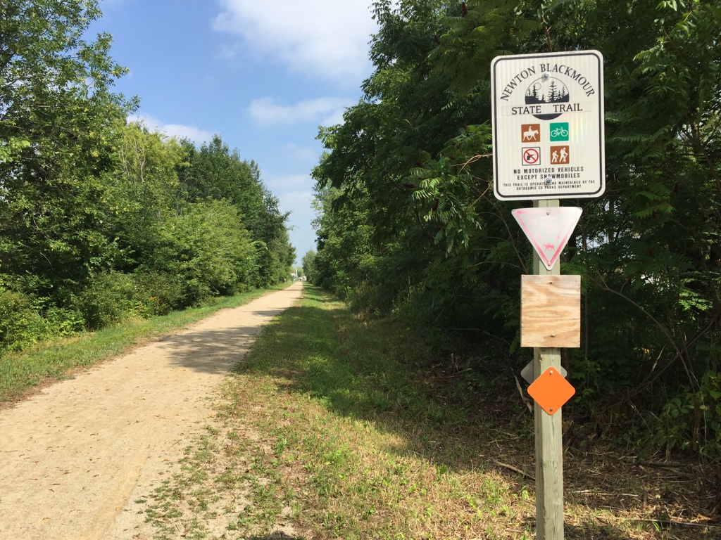
Official pageNewton Blackmour State Trail
State Trail
The Newton Blackmour State Trail spans 22 miles on a former rail corridor in Outagamie County, passing through New London, Shiocton, Black Creek and Seymour.
- Biking
- Hiking
Wisconsin DNR
Official pageNicolet State Trail
State Trail
This county-operated trail meanders more than 89 miles through the Nicolet National Forest in northeastern Wisconsin on a former railroad corridor.
- Biking
- Hiking
Wisconsin DNR
Official pageNorthern Highland American Legion State Forest
State Forest
The Northern Highland-American Legion State Forest spans over 236,000 acres with more than 900 lakes, offering remote boat-in campsites, developed campgrounds, beaches, boat launches and trails.
- Camping
- Boating
- Swimming
- Beach
Wisconsin DNR
Official pageOld Abe State Trail
State Trail
The paved 20-mile Old Abe State Trail connects Lake Wissota and Brunet Island state parks along an abandoned railroad grade following the Chippewa River shoreline.
- Biking
- Hiking
- Horseback Riding
- Wildlife Viewing
Wisconsin DNR
Official pagePattison State Park
State Park
Pattison State Park features the highest waterfall in Wisconsin, 165-foot Big Manitou Falls, across 1,400 acres with a lake, beach, nature center, camping and scenic hiking trails.
- Camping
- Hiking
- Swimming
- Beach
Wisconsin DNR
Official pagePerrot State Park
State Park
Perrot State Park is nestled among 500-foot bluffs where the Trempealeau and Mississippi rivers meet, offering river-view hiking trails, a marked canoe trail and access to the Great River State Trail.
- Camping
- Hiking
- Paddling
- Biking
Wisconsin DNR
Official pagePoint Beach State Forest
State Forest
Point Beach State Forest features 3,000 acres and 6 miles of sandy Lake Michigan beach, with family campsites, group cabins and the historic Rawley Point Lighthouse.
- Camping
- Cabins
- Beach
- Swimming
Wisconsin DNR
Official pagePotawatomi State Park
State Park
Potawatomi State Park on Sturgeon Bay in southern Door County has 1,200 acres of rolling upland terrain bordered by steep slopes and rugged limestone cliffs.
- Camping
- Hiking
- Picnicking
Wisconsin DNR
Official pageRed Cedar State Trail
State Trail
This 14.5-mile rail trail shadows the steep walls of the Red Cedar Valley from Menomonie to the Chippewa River State Trail, passing prairies, marshland, forests and sandstone bluffs.
- Biking
- Hiking
- Winter Sports
Wisconsin DNR
Official pageRib Mountain State Park
State Park
Rib Mountain State Park sits atop one of the oldest geological formations on earth, a day-use property with picnicking, hiking trails, an amphitheater and views of the Wausau area.
- Hiking
- Picnicking
- Winter Sports
Wisconsin DNR
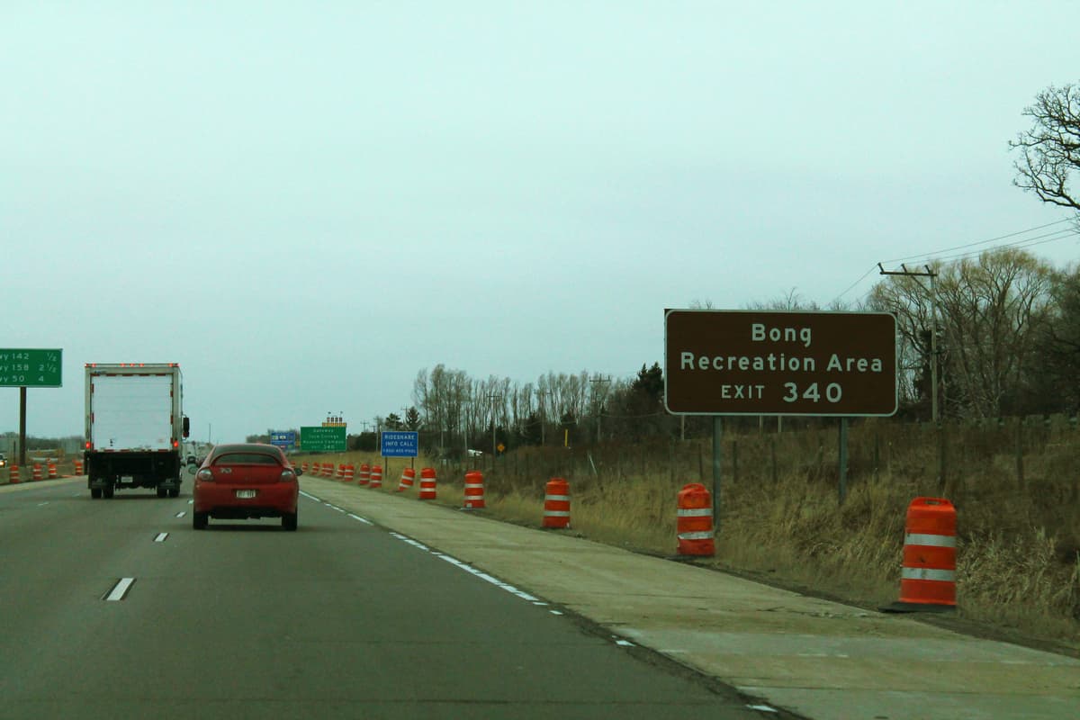
Official pageRichard Bong State Recreation Area
State Recreation Area
Richard Bong State Recreation Area, named for the World War II air ace, protects open space on a site once designated to be a jet fighter base.
- Camping
- Hiking
- Picnicking
- Hunting
Wisconsin DNR
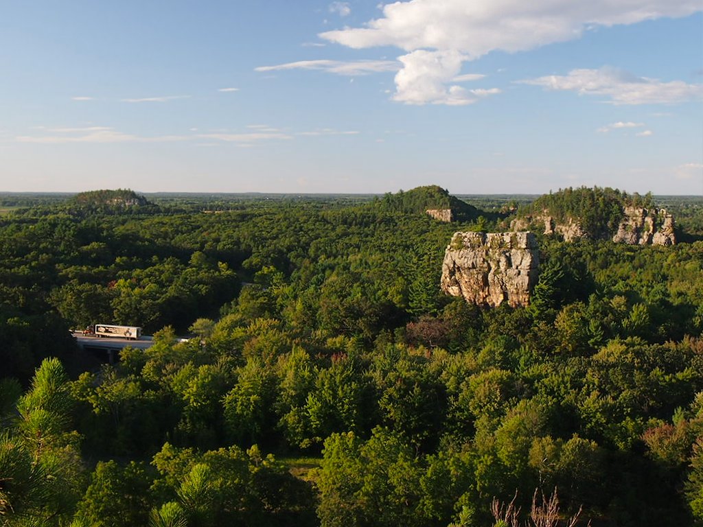
Official pageRoche-A-Cri State Park
State Park
Roche-A-Cri State Park protects a 300-foot rock outcropping and Native American petroglyphs and pictographs, offering camping, picnicking, fishing and a stairway to the top of the mound.
- Camping
- Hiking
- Fishing
- Picnicking
Wisconsin DNR
Official pageRock Island State Park
State Park
Reached by ferry, this primitive Lake Michigan island allows no vehicles and features the Pottawatomie Lighthouse, walk-in campsites, hiking trails and a swimming beach.
- Camping
- Hiking
- Swimming
- Beach
Wisconsin DNR
Official pageRocky Arbor State Park
State Park
Rocky Arbor State Park, 1.5 miles from Wisconsin Dells, offers seclusion with wooded campsites, hiking trails and picnic and playground areas among pine trees and sandstone bluffs.
- Camping
- Hiking
- Picnicking
- Playground
Wisconsin DNR
Official pageStraight Lake State Park
State Park
This 2,000-acre park offers lake views and glacial features along its trails, with ten walk-in campsites, carry-in boat launches and a premier segment of the Ice Age National Scenic Trail.
- Camping
- Hiking
- Boating
- Picnicking
Wisconsin DNR
Official pageSugar River State Trail
State Trail
The Sugar River State Trail follows an abandoned railroad line 24 miles from New Glarus to Brodhead, crossing fourteen trestle bridges past farmlands, woods and remnant prairies.
- Biking
- Hiking
Wisconsin DNR
Official pageTower Hill State Park
State Park
Tower Hill State Park outside Spring Green shows how lead shot was made in the mid-1800s, with bluff hiking trails, river views, a canoe landing and a small campground.
- Camping
- Hiking
- Paddling
- Picnicking
Wisconsin DNR
Official pageTuscobia State Trail
State Trail
One of the longest rail trails in the state at 74 miles, the Tuscobia State Trail runs from Park Falls to near Rice Lake through the Flambeau River State Forest and the Blue Hills.
- Biking
- Hiking
Wisconsin DNR
Official pageWhitefish Dunes State Park
State Park
Whitefish Dunes State Park protects a fragile dune environment on the eastern Door County Peninsula, a day-use park with Lake Michigan trails, a nature center and a beach.
- Hiking
- Beach
- Picnicking
- Nature Trails
Wisconsin DNR
Official pageWild Goose State Trail
State Trail
This 34-mile rail trail skirts the western edge of Horicon Marsh, a National Wildlife Refuge home to over 250 migrant bird species, running from Clyman Junction to Fond du Lac.
- Biking
- Hiking
- Wildlife Viewing
Wisconsin DNR
Official pageWildcat Mountain State Park
State Park
Located on a ridge above the Kickapoo River, Wildcat Mountain State Park offers twenty-one miles of hiking, nature and equestrian trails, camping and an overlook of the Kickapoo Valley.
- Camping
- Hiking
- Horseback Riding
- Paddling
Wisconsin DNR
Official pageWillow River State Park
State Park
Willow River State Park features views of Willow Falls and the Willow River Gorge across 2,800 acres with prairie remnants, scenic hiking trails, campgrounds and a nature center.
- Camping
- Hiking
- Paddling
- Fishing
Wisconsin DNR
Official pageWiouwash State Trail
State Trail
Named for the four counties it traverses, the Wiouwash State Trail follows a former rail corridor in two sections, 19 miles in Shawano County and 22 miles from Hortonville to Oshkosh.
- Biking
- Hiking
Wisconsin DNR
Official pageWyalusing State Park
State Park
Wyalusing State Park sits 500 feet above the confluence of the Wisconsin and Mississippi rivers, one of Wisconsin's oldest state parks with campsites, hiking trails, a canoe trail and Native American burial mounds.
- Camping
- Hiking
- Paddling
- Wildlife Viewing
Wisconsin DNR
Official pageYellowstone Lake State Park
State Park
The 450-acre Yellowstone Lake State Park is a year-round recreation area in southwestern Wisconsin offering camping, swimming, fishing, boating, hiking, biking and picnicking.
- Camping
- Swimming
- Fishing
- Boating
Wisconsin DNR
Official pageBearskin State Trail
State Trail
This 21.5-mile former railroad corridor between Minocqua and Tomahawk follows Bearskin Creek through Wisconsin's Northwoods on a compacted granite surface.
- Hiking
- Biking
- Winter Sports
Wisconsin DNR
Official pageCattail State Trail
State Trail
The Cattail State Trail runs 18 miles on a former rail corridor between Amery and Almena in northwestern Wisconsin through forests, farmlands, prairies and hills.
- Biking
- Hiking
- Wildlife Viewing
Wisconsin DNR
Official pageFenley State Recreation Area
State Recreation Area
This 287-acre property in Grant County consists of upland hardwoods and steep bluffs overlooking the Mississippi River.
Wisconsin DNR
Official pageGovernor Earl Peshtigo River State Forest
State Forest
This linear forest in northeast Wisconsin borders the Peshtigo River, with fly-fishing, the Midwest's longest continuous whitewater rapids and flowage boating.
- Fishing
- Paddling
- Boating
- Camping
Wisconsin DNR
Official pageGreat Sauk State Trail
State Trail
The Great Sauk State Trail parallels the Wisconsin River through Prairie du Sac and Sauk City, with 10.5 paved miles through the Sauk Prairie State Recreation Area.
- Biking
Wisconsin DNR
Official pageGreen Circle State Trail
State Trail
Encircling Stevens Point, this 31-mile trail meanders along the Wisconsin and Plover rivers through forests, wetlands, prairies, boardwalks and quiet neighborhoods.
- Hiking
- Biking
- Wildlife Viewing
Wisconsin DNR
Official pageHillsboro State Trail
State Trail
This 4-mile county-operated trail connects Hillsboro and Union Center, crossing wooded and agricultural lands, winding streams and the Baraboo River.
- Biking
Wisconsin DNR
Official pageLower Wisconsin State Riverway
State park system area
The Lower Wisconsin is the longest free-flowing stretch of river in the Midwest, extending 92 miles from Prairie du Sac to the Mississippi River with abundant sand bars popular for boat-in camping.
- Camping
- Boating
- Paddling
- Fishing
Wisconsin DNR
Official pageMascoutin Valley State Trail
State Trail
This county-operated rail trail passes farms, prairies and wetlands across two sections totaling 21 miles in Green Lake, Winnebago and Fond du Lac counties.
- Biking
- Hiking
Wisconsin DNR
Official pageMenominee River State Recreation Area
State Recreation Area
Menominee River State Recreation Area straddles the scenic Menominee River for several miles in northeast Wisconsin, offering canoeing among towering pines, rock outcrops and falls.
- Camping
- Hiking
- Fishing
- Hunting
Wisconsin DNR
Official pageMound View State Trail
State Trail
This gently rolling trail in southwest Wisconsin connects Platteville and Belmont, traveling along streams and open countryside past two large mounds rising above farm fields.
- Biking
- Hiking
Wisconsin DNR
Official pageOconto River State Trail
State Trail
This 8-mile trail passes through the forests and farms of Oconto County between Oconto and Stiles Junction, paralleling the Oconto River.
- Biking
- Hiking
- Paddling
Wisconsin DNR
Official pagePecatonica State Trail
State Trail
Running 10 miles through the Bonner Branch valley, this county-operated trail links Belmont with the Cheese Country Trail in Calamine along an old railroad corridor.
- Biking
- Hiking
- Horseback Riding
Wisconsin DNR
Official pageSauk Prairie State Recreation Area
State Recreation Area
Sauk Prairie State Recreation Area occupies a former army ammunition plant, once the largest munitions factory in the world during World War II, now managed for recreation and conservation.
- Historic Site
- Wildlife Viewing
Wisconsin DNR
Official pageSaunders State Trail
State Trail
This 8-mile county-operated trail links with the Gandy Dancer State Trail south of Superior in Douglas County, crossing Clear Creek and the Pokegama River.
- Biking
- Hiking
Wisconsin DNR
Official pageStower Seven Lakes State Trail
State Trail
Built on a former railroad corridor, this 14-mile trail runs from Amery toward Dresser through maple and oak forests, wetlands, prairies and farmlands past seven picturesque lakes.
- Biking
- Hiking
Wisconsin DNR
Official pageTomorrow River State Trail
State Trail
This 29-mile rail trail travels through scenic glacial terrain and farm country from Plover in Portage County to near Manawa in Waupaca County.
- Biking
- Hiking
- Horseback Riding
Wisconsin DNR
Official pageWhite River State Trail
State Trail
This 19-mile trail follows a former rail corridor between Elkhorn and Dover, passing bridges, scenic vistas, quaint towns, farmlands and wetlands near Lake Geneva.
- Biking
- Hiking
- Horseback Riding
Wisconsin DNR
Official pageWild Rivers State Trail
State Trail
The Wild Rivers State Trail stretches 104 miles through Douglas, Washburn and Barron counties, crossing numerous rivers including the federally designated Namakagon River.
- Biking
- Hiking
- Wildlife Viewing
Wisconsin DNR
Official pageWolf River State Trail
State Trail
The Wolf River State Trail runs 33 miles on a former rail corridor from White Lake to Crandon, skirting the Wolf River and the Nicolet National Forest.
- Biking
- Hiking
- Camping
- Hunting
Wisconsin DNR
Official page


Inventory source: USGS PAD-US 4.1. Photos are public-domain or Creative Commons via Wikimedia Commons, credited per image. Official reservations and rules remain state-specific, so use the state booking links before committing to dates.
Frequently asked questions
What is the best national park in Wisconsin?
Wisconsin has no full national park, but Apostle Islands National Lakeshore on Lake Superior is the standout National Park Service site. It covers 21 islands and 12 miles of mainland coast, with sea caves you can kayak through in summer and more lighthouses than any other NPS unit. Use Bayfield as your base for ferries, cruises, and kayak rentals.
When is the best time to visit Wisconsin parks?
Late summer through early fall (roughly August into October) is the sweet spot: mild weather, fewer bugs, thinner crowds, and fall color that starts up north. Summer (highs in the 70s to low 80s F) is best for swimming, paddling, and the Apostle Islands sea-cave tours that run mid-June into early October. Winter brings snowshoeing and cross-country skiing, plus the rare chance at the Apostle Islands ice caves when Lake Superior freezes solid enough.
What is the most popular state park in Wisconsin?
Devil's Lake State Park near Baraboo is the busiest in the state. It centers on a clear 360-acre lake ringed by 500-foot quartzite bluffs, with hiking like the Balanced Rock and East Bluff trails plus swimming, paddling, and climbing. It sits along the Ice Age National Scenic Trail and is an easy drive from both Madison and Milwaukee.