Destinations
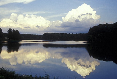
Illinois outdoors
Illinois trades elevation for variety: river-cut canyons up north, ancient sandstone cliffs down south, all on free-entry state land.
Top parks in Illinois
See all 135 parksMatthiessen State Park
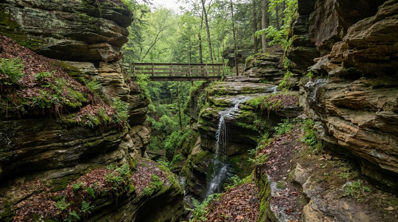
The quieter canyon park next to Starved Rock: dells, seasonal waterfalls, a streambed loop, and five miles of marked trails. Day-use only, no tent camping.
Starved Rock State Park
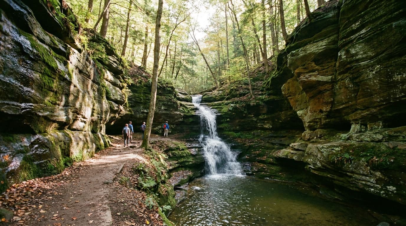
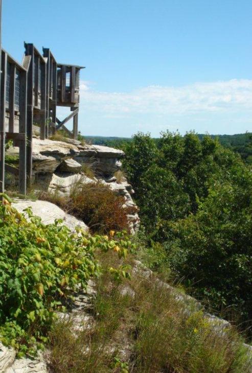
Illinois's canyon-and-waterfall flagship on the Illinois River: 18 sandstone canyons, a historic lodge, a reservation-required campground, and winter eagle watching.

Adeline Jay Geo-Karis Illinois Beach State Park
Illinois Beach State Park stretches 6.5 miles along the sandy shore of Lake Michigan, with dunes, swales, marshes, and oak forests across two units.

Giant City State Park
Giant City State Park near Carbondale is nestled in the Shawnee National Forest and named for massive sandstone structures formed 12,000 years ago.

Pere Marquette State Park
Pere Marquette State Park offers spectacular bluff-top views of the Illinois River and year-round recreation including horseback riding and camping.
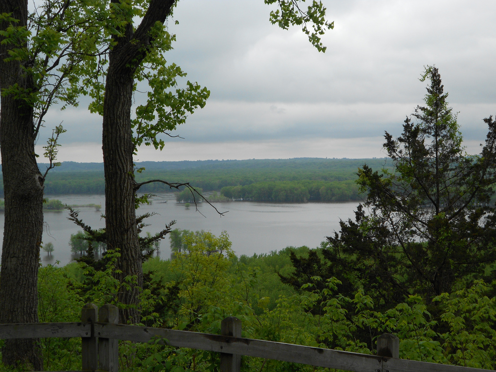
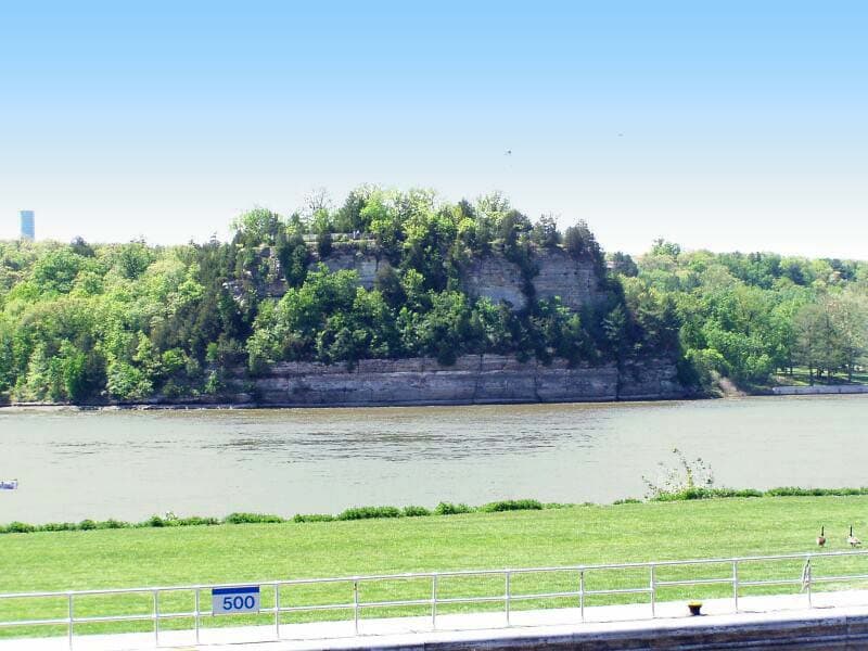
Mississippi Palisades State Park
Mississippi Palisades State Park is a 2,500-acre park near the confluence of the Mississippi and Apple rivers, rich in Native American history.

Ferne Clyffe State Park
Ferne Clyffe State Park is known for abundant ferns, rock formations, and trails through picturesque woods on a 2,470-acre site in Johnson County.

Cave-in-Rock State Park
Cave-in-Rock State Park sits atop bluffs above the Ohio River and is named for a 55-foot-wide cave carved from limestone by water.

Apple River Canyon State Park
Apple River Canyon State Park sits in the hilly northwest corner of Illinois, with limestone bluffs, deep ravines, springs, and streams formed by the Apple River.
Planning a Illinois trip
Illinois surprises people. There is no national park here, but the state quietly packs in some of the best canyon and cliff hiking in the Midwest, and almost all of it is free to enter.
Start with the two anchors. Up north, about 90 minutes southwest of Chicago, Starved Rock State Park carves 18 sandstone canyons along the Illinois River, with roughly 13 miles of trail that lead to seasonal waterfalls (best after spring rain or a winter thaw, when a few canyons freeze into ice columns). Far to the south, Shawnee National Forest spreads across 289,000 acres of oak-hickory hills between the Ohio and Mississippi rivers. Its crown jewel is Garden of the Gods, where 320-million-year-old sandstone has weathered into formations like Camel Rock and Devil's Smokestack. The quarter-mile Observation Trail there is one of the best effort-to-view ratios in the country: a short, mostly easy loop that opens onto miles of unbroken forest from the cliff edge.
There is more once you start looking. Giant City State Park near Makanda has shaded bluff trails and a historic lodge, Mississippi Palisades near Savanna stacks river overlooks on limestone cliffs, and quieter spots like Pomona Natural Bridge and the Little Grand Canyon reward a short detour.
For timing, spring (April to May) and fall (late September to October) are the sweet spots: temperatures in the 50s to 70s F, lower crowds in spring, and serious fall color across the Shawnee in October. Summer turns hot and humid (high 80s F and sticky), which makes the shaded canyon trails the smart play. Winter is cold but real hikers love the frozen Starved Rock waterfalls.
On packing: this is forgiving terrain with one catch, which is footing. Trails here are often wet sandstone, mud, and the occasional staircase, so the through-line is grippy waterproof shoes, layers you can shed as the day warms, and bug protection in summer. You are never far from a trailhead, so day-hiking light is the move.
Getting around Illinois
Most trips through outdoor Illinois start in Chicago, served by O'Hare (ORD) and Midway (MDW), the region's two big air hubs. From the Chicago area, Starved Rock is the easy win: roughly 95 miles and about 90 minutes to two hours southwest via I-80 and I-39 to Oglesby. Mississippi Palisades, up on the northwest border near Savanna, is about 140 miles (two and a half to three hours) from Chicago.
The Shawnee National Forest sits at the opposite end of the state and is a genuine road trip from Chicago: roughly 320 to 360 miles and about five to six hours south. If the Shawnee is your main target, fly into St. Louis (STL) instead, which puts you within about 130 to 150 miles (two to two and a half hours) of Garden of the Gods. Smaller regional options include Peoria (PIA) for central Illinois and Marion/Williamson County (MWA) deep in the south near the forest.
Distances between the headline areas are real, so plan north and south as separate trips rather than one loop: Starved Rock to the Shawnee is roughly five hours of driving. Within the Shawnee itself, the main sights (Garden of the Gods, Giant City, Pomona Natural Bridge) are spread across rolling backroads, so budget 30 to 60 minutes of driving between trailheads and keep a full tank, since gas and services thin out fast once you leave the towns.
State park directory
Every Illinois state park
A source-backed inventory layer for planning breadth. Full Kit Authority guides are marked when a park has camping detail, rules, and packing notes; the rest link straight to the official page.
135 parks
2 full guides · 70 with photos
Matthiessen State Park
State Park
Matthiessen State Park in LaSalle County combines canyons, streams, prairie, and forest with notable rock formations near Utica.
- Camping
- Winter Sports
- Horseback Riding
- Fishing
Illinois DNR
Full guideStarved Rock State Park
State Park
Starved Rock State Park in northwestern Illinois is known for scenic canyons, waterfalls, and bluff-top views, with winter bald eagle viewing.
- Hiking
- Wildlife Viewing
- Camping
- Picnicking
Illinois DNR
Full guideAdeline Jay Geo-Karis Illinois Beach State Park
State Park
Illinois Beach State Park stretches 6.5 miles along the sandy shore of Lake Michigan, with dunes, swales, marshes, and oak forests across two units.
- Camping
- Hiking
- Fishing
- Boating
Illinois DNR
Official pageApple River Canyon State Park
State Park
Apple River Canyon State Park sits in the hilly northwest corner of Illinois, with limestone bluffs, deep ravines, springs, and streams formed by the Apple River.
- Camping
- Fishing
- Hiking
- Hunting
Illinois DNR
Official pageArgyle Lake State Park
State Park
Argyle Lake State Park offers a 93-acre lake for boating and fishing plus 5 miles of foot trails through forest on a heavily wooded 1,700-acre site near Macomb.
- Camping
- Boating
- Fishing
- Hiking
Illinois DNR
Official pageBanner Marsh State Fish and Wildlife Area
State Fish and Wildlife Area
Banner Marsh is a fish and wildlife area southwest of Peoria, protected from the Illinois River by a major levee and teeming with fish and wildlife.
- Hunting
- Fishing
- Boating
- Picnicking
Illinois DNR
Official pageBeaver Dam State Park
State Park
Beaver Dam State Park sits in oak and hickory woodland near Carlinville and is named for a beaver dam that created its lake.
- Camping
- Fishing
- Hiking
- Picnicking
Illinois DNR
Official pageBig Bend
State park system area
Big Bend is mostly bottomlands along the Rock River interspersed with native grasslands, woods, oxbow lakes, wetlands, and marshes.
- Hunting
- Wildlife Viewing
Illinois DNR
Official pageBuffalo Rock State Park
State Park
Buffalo Rock State Park sits on a bluff above the Illinois River near Ottawa, offering sweeping river views on a 298-acre site.
- Hiking
- Hunting
- Biking
- Winter Sports
Illinois DNR
Official pageCache River State Natural Area
State Natural Area
Cache River State Natural Area in southernmost Illinois holds ancient bald cypress trees and wetlands designated of international importance.
- Boating
- Fishing
- Hiking
- Hunting
Illinois DNR
Official pageCastle Rock State Park
State Park
Castle Rock State Park lies along the west bank of the Rock River in Ogle County, with rock formations, ravines, and a sandstone bluff that names the park.
- Camping
- Boating
- Fishing
- Hiking
Illinois DNR
Official pageCave-in-Rock State Park
State Park
Cave-in-Rock State Park sits atop bluffs above the Ohio River and is named for a 55-foot-wide cave carved from limestone by water.
- Camping
- Fishing
- Hiking
- Boating
Illinois DNR
Official pageChain O' Lakes State Park
State Park
Chain O' Lakes State Park sits in the heart of Illinois' largest concentration of natural lakes, bordering three natural lakes and the Fox River.
- Camping
- Boating
- Fishing
- Hunting
Illinois DNR
Official pageChannahon State Park
State Park
Channahon State Park is the official trailhead for the Illinois and Michigan Canal State Trail, preserving Locks 6 and 7 and an original locktender's house.
- Camping
- Fishing
- Picnicking
- Paddling
Illinois DNR
Official pageDes Plaines State Fish and Wildlife Area
State Fish and Wildlife Area
Des Plaines Fish and Wildlife Area spans more than 5,000 acres of farmland, woodland, prairie, swamp, and shoreline south of Joliet.
- Boating
- Camping
- Fishing
- Hunting
Illinois DNR
Official pageDixon Springs State Park
State Park
Dixon Springs State Park sits on a giant block of sandstone in the Shawnee Hills, with canyons and waterfalls along a fault line in Pope County.
- Camping
- Fishing
- Hiking
- Hunting
Illinois DNR
Official pageEagle Creek State Park
State Park
Eagle Creek State Park faces Wolf Creek across Lake Shelbyville in east central Illinois, with woodland and large tracts along the lake.
- Camping
- Boating
- Fishing
- Hiking
Illinois DNR
Official pageFerne Clyffe State Park
State Park
Ferne Clyffe State Park is known for abundant ferns, rock formations, and trails through picturesque woods on a 2,470-acre site in Johnson County.
- Camping
- Horseback Riding
- Fishing
- Hiking
Illinois DNR
Official pageFort Defiance State Park
State Park
Fort Defiance State Park sits on Cairo Point, the southernmost tip of Illinois, where the Ohio and Mississippi rivers meet at one of the world's largest confluences.
- Fishing
- Picnicking
Illinois DNR
Official pageFort Massac State Park
State Park
Fort Massac State Park overlooks the Ohio River at the southern tip of Illinois and was the state's first state park, established in 1908.
- Biking
- Boating
- Camping
- Fishing
Illinois DNR
Official pageFox Ridge State Park
State Park
Fox Ridge State Park near Charleston is known for steep wooded ridges, lush valleys, and rugged hiking trails along the bluffs of the Embarras River.
- Picnicking
- Camping
- Hiking
- Fishing
Illinois DNR
Official pageFranklin Creek State Natural Area
State Natural Area
Franklin Creek State Natural Area in Lee County features springs, hardwood forests, bedrock outcroppings, and a reconstructed 1847 grist mill.
- Fishing
- Hiking
- Hunting
- Horseback Riding
Illinois DNR
Official pageFults Hill Prairie State Natural Area
State Natural Area
Fults Hill Prairie State Natural Area holds the largest complex of high-quality loess hill prairies in Illinois, with woodland, prairie, and glade communities.
- Hiking
- Hunting
Illinois DNR
Official pageGebhard Woods State Park
State Park
Gebhard Woods State Park in Morris is a 30-acre site bordered by the Illinois and Michigan Canal and Nettle Creek, shaded by stately old trees.
- Camping
- Fishing
- Hiking
- Picnicking
Illinois DNR
Official page


Show 111 more Illinois parks
Giant City State Park
State Park
Giant City State Park near Carbondale is nestled in the Shawnee National Forest and named for massive sandstone structures formed 12,000 years ago.
- Camping
- Horseback Riding
- Fishing
- Hiking
Illinois DNR
Official pageGoose Lake Prairie State Natural Area
State Natural Area
Goose Lake Prairie State Natural Area preserves the prairies that once covered nearly 60 percent of Illinois, with most of it a dedicated nature preserve.
- Hiking
- Hunting
- Winter Sports
- Picnicking
Illinois DNR
Official pageHamilton County
State park system area
Hamilton County State Fish and Wildlife Area, also known as Dolan Lake, centers on a 75-acre lake stocked with bass, bluegill, crappie, and catfish.
- Boating
- Camping
- Fishing
- Hiking
Illinois DNR
Official pageHennepin Canal State Trail
State Trail
The Hennepin Canal State Trail is a 104.5-mile linear park spanning five counties along a historic canal listed on the National Register of Historic Places.
- Biking
- Boating
- Camping
- Paddling
Illinois DNR
Official pageHorseshoe Lake Alexander County
State park system area
Horseshoe Lake in Alexander County is a 10,200-acre area with a 2,400-acre shallow lake bordered by bald cypress, tupelo gum, and wild lotus.
- Boating
- Fishing
- Hunting
- Picnicking
Illinois DNR
Official pageHorseshoe Lake State Park (Madison County)
State Park
Horseshoe Lake State Park in Madison County offers recreation on 2,960 acres with easy access from the Metro East region.
- Boating
- Camping
- Fishing
- Hiking
Illinois DNR
Official pageIllini State Park
State Park
Illini State Park is a 510-acre riverside site south of the Illinois River with rustic Civilian Conservation Corps buildings and views of the Marseilles Locks.
- Boating
- Camping
- Fishing
- Hiking
Illinois DNR
Official pageIllinois Caverns State Natural Area
State Natural Area
Illinois Caverns State Natural Area in Monroe County is a limestone cave with stalactites, stalagmites, flowstone, and an underground stream.
- Wildlife Viewing
Illinois DNR
Official pageJohnson-Sauk Trail State Recreation Area
State Recreation Area
Johnson-Sauk Trail State Recreation Area sits on a glacial moraine in Henry County across 1,365 acres of rolling hills and oak woodland.
- Boating
- Camping
- Fishing
- Hiking
Illinois DNR
Official pageJubilee College State Park
State Park
Jubilee College State Park is a 3,200-acre facility in Peoria County with rolling topography and the meandering Jubilee Creek.
- Camping
- Winter Sports
- Horseback Riding
- Fishing
Illinois DNR
Official pageKankakee River State Park
State Park
Kankakee River State Park envelops both sides of the Kankakee River for 11 miles across roughly 4,000 acres northwest of Kankakee.
- Biking
- Boating
- Camping
- Paddling
Illinois DNR
Official pageKaskaskia River
State park system area
Kaskaskia River State Fish and Wildlife Area spans more than 20,000 acres along the Kaskaskia River and includes the 2,018-acre Baldwin Lake reservoir.
- Boating
- Camping
- Fishing
- Hiking
Illinois DNR
Official pageKidd Lake State Natural Area
State Natural Area
Kidd Lake State Natural Area is a bottomland marsh vegetated with bulrush, cattail, and smartweed, with small ponds of open water.
- Hiking
- Wildlife Viewing
Illinois DNR
Official pageLake Murphysboro State Park
State Park
Lake Murphysboro State Park is a 1,022-acre park in Jackson County surrounding star-shaped Lake Murphysboro.
- Boating
- Camping
- Fishing
- Hiking
Illinois DNR
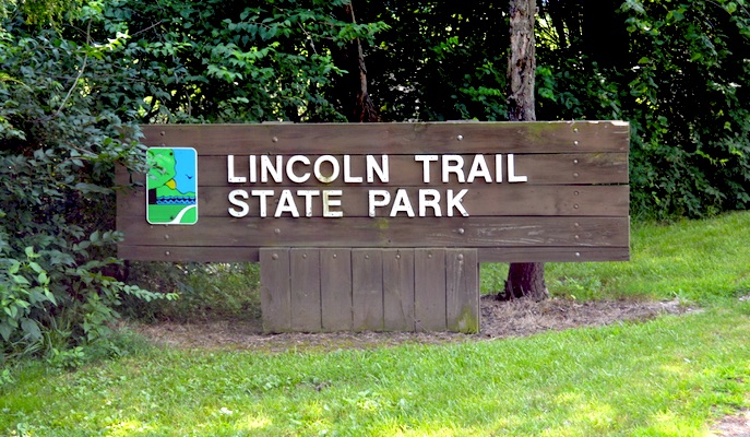
Official pageLincoln Trail State Park
State Park
Lincoln Trail State Park is a 1,023-acre park near Marshall named for the route Lincoln's family followed from Indiana to Illinois in 1831.
- Boating
- Camping
- Fishing
- Hiking
Illinois DNR
Official pageLowden State Park
State Park
Lowden State Park north of Oregon overlooks the Rock River and features Lorado Taft's 50-foot statue commonly associated with Chief Black Hawk.
- Boating
- Camping
- Paddling
- Winter Sports
Illinois DNR
Official pageMarshall SFWA
State park system area
Marshall State Fish and Wildlife Area spans about 6,000 acres of Illinois River backwaters, bottomlands, and bluffs in the heart of the mallard flyway.
- Boating
- Camping
- Paddling
- Winter Sports
Illinois DNR
Official pageMermet Lake State Fish and Wildlife Area
State Fish and Wildlife Area
Mermet Lake State Fish and Wildlife Area near Metropolis is an old cypress swamp of 2,630 acres managed for waterfowl hunting and fishing.
- Boating
- Fishing
- Hiking
- Hunting
Illinois DNR
Official pageMississippi Palisades State Park
State Park
Mississippi Palisades State Park is a 2,500-acre park near the confluence of the Mississippi and Apple rivers, rich in Native American history.
- Camping
- Winter Sports
- Fishing
- Geocaching
Illinois DNR
Official pageMoraine Hills State Park & McHenry Dam State Park
State Park
Moraine Hills State Park south of McHenry covers 2,200 acres of wetlands and lakes with more than ten miles of trails.
- Biking
- Boating
- Winter Sports
- Fishing
Illinois DNR
Official pageMorrison-Rockwood State Park
State Park
Morrison-Rockwood State Park features stream-fed Lake Carlton, a prime fishing location surrounded by hardwood forest.
- Boating
- Camping
- Winter Sports
- Horseback Riding
Illinois DNR
Official pageNauvoo
State park system area
Nauvoo State Park is a 148-acre park on the Mississippi River in Hancock County with a 13-acre lake and historic surroundings.
- Boating
- Camping
- Winter Sports
- Fishing
Illinois DNR
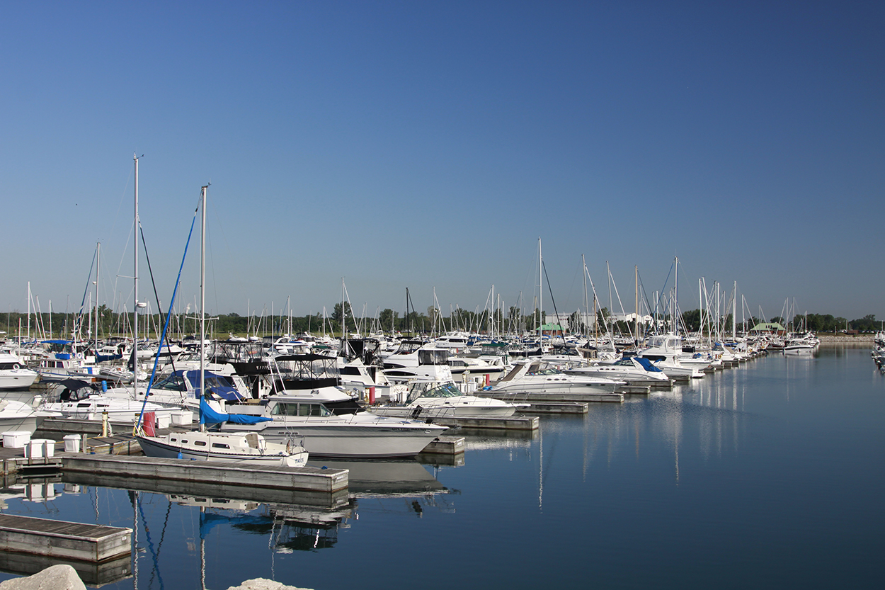
Official pageNorth Point Marina State Recreation Area
State Recreation Area
North Point Marina is the largest marina on the Great Lakes, offering 1,500 slips and Lake Michigan access on the Illinois lakeshore.
- Biking
- Boating
- Fishing
- Hiking
Illinois DNR
Official pagePeabody River King
State park system area
Peabody-River King State Fish and Wildlife Area is a 2,000-acre former surface mine in St. Clair County with more than 20 lakes and ponds.
- Fishing
- Hunting
- Wildlife Viewing
Illinois DNR
Official pagePere Marquette State Park
State Park
Pere Marquette State Park offers spectacular bluff-top views of the Illinois River and year-round recreation including horseback riding and camping.
- Horseback Riding
- Camping
- Hiking
- Fishing
Illinois DNR
Official pagePiney Creek Ravine State Natural Area
State Natural Area
Piney Creek Ravine State Natural Area is a 198-acre nature preserve and one of only two Illinois sites where short-leaf pines grow naturally.
- Hiking
Illinois DNR
Official pagePowerton Lake State Fish & Wildlife Area
State Fish and Wildlife Area
Powerton Lake is a 1,426-acre cooling reservoir, about 60 percent of which is open to waterfowl hunting with the remainder a rest area.
- Hunting
Illinois DNR
Official pageProphetstown State Park
State Park
Prophetstown State Park is a 53-acre historic park along the Rock River, named for the Native American prophet Wa-bo-kie-shiek.
- Boating
- Camping
- Fishing
- Hiking
Illinois DNR
Official pageRed Hills State Park
State Park
Red Hills State Park in Lawrence County preserves 967 acres of wooded hills and a 40-acre lake, with the highest point between St. Louis and Cincinnati.
- Biking
- Boating
- Camping
- Winter Sports
Illinois DNR
Official pageRock Cut State Park
State Park
Rock Cut State Park in Winnebago County spans 3,254 acres with two lakes, Pierce Lake and Olson Lake, for fishing, ice fishing, and skating.
- Biking
- Boating
- Camping
- Winter Sports
Illinois DNR
Official pageRock Island Trail State Park
State Park
Rock Island Trail State Park is a 26-mile rail trail from Alta to Toulon through a tree-canopied corridor of prairie grasses and wildflowers.
- Biking
- Camping
- Winter Sports
- Hiking
Illinois DNR
Official pageSand Ridge State Forest
State Forest
Sand Ridge State Forest is the largest of Illinois' state forests at 7,550 acres of oak-hickory woodland, pine plantations, and sand prairies.
- Camping
- Winter Sports
- Horseback Riding
- Geocaching
Illinois DNR
Official pageSanganois State Fish & Wildlife Area
State Fish and Wildlife Area
Sanganois State Fish and Wildlife Area is a bottomland complex of sloughs, backwater lakes, and timber with roughly 500 acres open to walk-in hunting.
- Hunting
Illinois DNR
Official pageSangchris Lake State Park
State Park
Sangchris Lake State Park southeast of Springfield exceeds 3,000 acres with 120 miles of shoreline on a 1964 power station cooling lake.
- Boating
- Camping
- Horseback Riding
- Fishing
Illinois DNR
Official pageSiloam Springs State Park
State Park
Siloam Springs State Park east of Quincy in Adams County is a 3,323-acre site of wooded terrain and a sparkling lake.
- Boating
- Camping
- Horseback Riding
- Fishing
Illinois DNR
Official pageSilver Springs State Fish and Wildlife Area
State Fish and Wildlife Area
Silver Springs State Fish and Wildlife Area is named for a clear bubbling spring, with the Fox River and several small lakes running through it.
- Boating
- Camping
- Paddling
- Winter Sports
Illinois DNR
Official pageSpring Lake State Fish and Wildlife Area
State Fish and Wildlife Area
Spring Lake State Fish and Wildlife Area in Tazewell County surrounds a long, narrow lake formed by a meander of the Illinois River.
- Boating
- Camping
- Winter Sports
- Fishing
Illinois DNR
Official pageTrail of Tears State Forest
State Forest
Trail of Tears State Forest in western Union County spans just over 5,000 acres managed for timber, wildlife, and recreation.
- Camping
- Horseback Riding
- Fishing
- Hiking
Illinois DNR
Official pageTunnel Hill State Trail
State Trail
Tunnel Hill State Trail stretches 45 miles from Harrisburg to Karnak along a former railroad bed, crossing scenic bluffs, creeks, and an old rail tunnel in southern Illinois.
- Hiking
- Biking
Illinois DNR
Official pageVolo Bog State Natural Area
State Natural Area
Volo Bog State Natural Area, northwest of Chicago, is home to the only open-water quaking bog in Illinois and is a National Natural Landmark with a floating boardwalk.
- Hiking
- Hunting
- Picnicking
- Winter Sports
Illinois DNR
Official pageWalnut Point State Park
State Park
Walnut Point State Park in east-central Illinois is a 671-acre site offering fishing, hunting, camping, hiking, and picnicking around its lake near Charleston.
- Camping
- Fishing
- Boating
- Hiking
Illinois DNR
Official pageWashington County State Recreation Area
State Recreation Area
Washington County State Recreation Area south of Nashville features the 248-acre Washington County Lake, abundant wildlife, and more than 900 acres for hunting.
- Camping
- Boating
- Fishing
- Hiking
Illinois DNR
Official pageWhite Pines Forest State Park
State Park
White Pines Forest State Park is a 385-acre park in the Rock River valley with moss-covered cliffs, creeks, a historic CCC-built lodge, and cabins.
- Camping
- Fishing
- Hiking
- Hunting
Illinois DNR
Official pageWilliam W. Powers State Recreation Area
State Recreation Area
William W. Powers State Recreation Area sits on Wolf Lake on Chicago's far southeast side, offering outstanding fishing along about six miles of shoreline.
- Boating
- Fishing
- Hiking
- Hunting
Illinois DNR
Official pageWolf Creek State Park
State Park
Wolf Creek State Park lies on Lake Shelbyville in east-central Illinois, with wooded campgrounds, a swimming beach, and abundant wildlife across thousands of acres.
- Camping
- Boating
- Fishing
- Hiking
Illinois DNR
Official pageWoodford SFWA
State park system area
Woodford State Fish and Wildlife Area is a 2,900-acre site of bottomland forest and backwater lakes along the Illinois River, a favorite stopping point for migrating waterfowl.
- Camping
- Fishing
- Hunting
- Picnicking
Illinois DNR
Official pageAnderson Lake SFWA
State park system area
Anderson Lake is a floodplain lake that frequently receives overflow from the Illinois River, set in a bottomland of silver maple, cottonwood, and willow.
- Camping
- Fishing
- Boating
- Hunting
Illinois DNR
Official pageBeall Woods State Park
State Park
Beall Woods State Park, on the banks of the Wabash River, preserves one of the few remaining tracts of virgin timber east of the Mississippi River.
- Camping
- Hiking
- Fishing
- Boating
Illinois DNR
Official pageBig River State Forest
State Forest
Big River State Forest in Henderson County is a 2,900-acre remnant of prairie woodland border managed to demonstrate sound forestry practices.
- Camping
- Boating
- Fishing
- Hiking
Illinois DNR
Official pageBurning Star State Fish and Wildlife Area
State Fish and Wildlife Area
Burning Star is a former coal mining site reclaimed into a fish and wildlife area with forests, grassland, wetlands, and 24 lakes and ponds.
- Fishing
- Hunting
- Boating
- Hiking
Illinois DNR
Official pageCape Bend State Fish and Wildlife Area
State Fish and Wildlife Area
Cape Bend is a fish and wildlife area of bottomland hardwood forest, reforested crop fields, wetlands, and shallow water sloughs.
- Hunting
Illinois DNR
Official pageCarlyle Lake SFWA
State park system area
Carlyle Lake State Fish and Wildlife Area lies at the northern end of Carlyle Lake, with woodland, open water, wetlands, grassland, and cropland for wildlife.
- Fishing
- Hunting
- Wildlife Viewing
Illinois DNR
Official pageClinton Lake State Recreation Area
State Recreation Area
Clinton Lake State Recreation Area surrounds a 4,900-acre cooling lake in east central Illinois, with boat launches, a sand beach, and trails.
- Camping
- Boating
- Fishing
- Hiking
Illinois DNR
Official pageCoffeen Lake State Fish and Wildlife Area
State Fish and Wildlife Area
Coffeen Lake is a fish and wildlife area opened in 1986 under a lease with Illinois Power, offering fishing, boating, picnicking, and hunting.
- Fishing
- Boating
- Picnicking
- Hunting
Illinois DNR
Official pageCrawford County Fish and Wildlife Area
State park system area
Crawford County Fish and Wildlife Area is a rolling landscape bisected by Hutson Creek, with mature oak-hickory forest, farmed openings, wetlands, and ponds.
- Hunting
Illinois DNR
Official pageDelabar State Park
State Park
Delabar State Park sits on the Mississippi River near Oquawka, with forested acres of oak, birch, and hickory and more than 50 species of birds recorded.
- Boating
- Camping
- Fishing
- Hiking
Illinois DNR
Official pageDevils Island Wildlife Management Area
State park system area
Devils Island Wildlife Management Area is composed of bottomland, hardwood forests, and agricultural fields.
- Hunting
Illinois DNR
Official pageDonnelley/DePue SFWAs
State park system area
The Donnelley/DePue State Fish and Wildlife Areas complex is managed primarily for migratory waterfowl at the entry to the lower Illinois River valley.
- Boating
- Fishing
- Hiking
- Hunting
Illinois DNR
Official pageEdward R. Madigan State Park
State Park
Edward R. Madigan State Park is a 974-acre site along Salt Creek south of Lincoln, with a forest canopy that includes the largest sycamore tree in Illinois.
- Boating
- Fishing
- Hiking
- Hunting
Illinois DNR
Official pageEldon Hazlet State Recreation Area
State Recreation Area
Eldon Hazlet State Recreation Area is a 3,000-acre site on the western shore of Carlyle Lake, with one of the largest campgrounds in the state park system.
- Camping
- Boating
- Fishing
- Hiking
Illinois DNR
Official pageFall Creek Scenic Overlook SNA
State park system area
Fall Creek Scenic Overlook, a unit of Siloam Springs State Park, overlooks the Mississippi River valley with high-quality forested habitat.
- Fishing
- Hiking
- Hunting
Illinois DNR
Official pageFrank Holten State Park
State Park
Frank Holten State Park is an urban recreation site in East St. Louis with an 18-hole golf course and two lakes totaling more than 200 acres.
- Boating
- Fishing
- Golf
- Hunting
Illinois DNR
Official pageGolconda Marina
State park system area
Golconda Marina is a 274-acre full-service boat marina along the Ohio River, serving as the gateway to the Smithland Pool area.
- Boating
- Fishing
Illinois DNR
Official pageGreen River SWA
State park system area
Green River State Wildlife Area is a 2,565-acre wildlife restoration area of swampy sloughs, prairie restorations, fields, and timberlands.
- Camping
- Horseback Riding
- Hiking
- Hunting
Illinois DNR
Official pageHarry 'Babe' Woodyard State Natural Area
State Natural Area
Harry 'Babe' Woodyard State Natural Area is a wooded area with upland prairie openings and a rocky creek running through a draw bisecting the park.
- Hunting
Illinois DNR
Official pageHeidecke Lake SFWA
State park system area
Heidecke Lake State Fish and Wildlife Area is managed for fishing and hunting on a former cooling lake providing more than 1,300 acres of water.
- Boating
- Camping
- Hiking
- Hunting
Illinois DNR
Official pageHenderson County Conservation Area
State park system area
Henderson County Conservation Area includes 27-acre Gladstone Lake on an 87-acre site about 20 miles southwest of Monmouth.
- Boating
- Camping
- Fishing
- Picnicking
Illinois DNR
Official pageHidden Springs State Forest
State Forest
Hidden Springs State Forest consists of about 1,200 acres near Clarksburg and is named for seven springs once used for drinking water by early settlers.
- Camping
- Fishing
- Hiking
- Hunting
Illinois DNR
Official pageIllinois and Michigan Canal State Trail
State Trail
The Illinois and Michigan Canal State Trail follows a 96-mile route past state parks, historic sites, and varied landscapes along the old towpath.
- Hiking
- Biking
- Fishing
- Camping
Illinois DNR
Official pageIroquois County State Wildlife Area
State Wildlife Area
Iroquois County State Wildlife Area sits in a low glacial outwash plain of marshland, sand ridges, and dunes, including the Hooper Branch Savanna.
- Hiking
- Hunting
- Winter Sports
Illinois DNR
Official pageJames "Pate" Philip State Park
State Park
James 'Pate' Philip State Park preserves restored prairie, wetland, and creek habitat near Bartlett, adding open space adjacent to Pratt's Wayne Woods.
- Biking
- Winter Sports
- Fishing
- Hiking
Illinois DNR
Official pageJim Edgar Panther Creek State Fish and Wildlife Area
State Fish and Wildlife Area
Jim Edgar Panther Creek is a 16,550-acre fish and wildlife area of mature forest, agricultural land, grassland, and rare hill prairie in central Illinois.
- Camping
- Boating
- Fishing
- Hunting
Illinois DNR
Official pageKickapoo State Recreation Area
State Recreation Area
Kickapoo State Recreation Area near Danville spans 2,842 reclaimed acres with 22 deep-water ponds for boating, fishing, camping, and hiking.
- Boating
- Camping
- Paddling
- Fishing
Illinois DNR
Official pageKinkaid Lake SFWA
State park system area
Kinkaid Lake in Jackson County is a 2,750-acre lake built in 1968, popular for fishing, boating, hunting, and camping.
- Boating
- Camping
- Fishing
- Hunting
Illinois DNR
Official pageLake Le-Aqua-Na State Recreation Area
State Recreation Area
Lake Le-Aqua-Na State Recreation Area in Stephenson County centers on a 40-acre lake with multi-use trails and several campgrounds.
- Biking
- Boating
- Camping
- Winter Sports
Illinois DNR
Official pageLaSalle Lake SFWA
State park system area
LaSalle Lake is a manmade 2,058-acre cooling lake southeast of Marseilles, popular among anglers and boaters.
- Boating
- Fishing
Illinois DNR
Official pageLincoln Trail Homestead State Park & Memorial
State Park
Lincoln Trail Homestead State Park and Memorial is an 82-acre historic site on the Sangamon River near Harristown commemorating Abraham Lincoln's first Illinois home.
- Boating
- Fishing
- Hiking
- Picnicking
Illinois DNR
Official pageLittle Grassy Fish Hatchery
State park system area
Little Grassy Fish Hatchery south of Carbondale is Illinois' warm-water hatchery, open to the public on weekdays for visits and tours.
Illinois DNR
Official pageLowden-Miller
State park system area
Lowden-Miller is a 2,291-acre wooded area in the Rock River Valley south of Oregon, reforested with pines by Governor Frank O. Lowden.
- Winter Sports
- Horseback Riding
- Hiking
Illinois DNR
Official pageMackinaw River SFWA
State park system area
Mackinaw River State Fish and Wildlife Area near Mackinaw consists of rolling timbered hills and former farmland bisected by the Mackinaw River.
- Paddling
- Fishing
- Hiking
- Hunting
Illinois DNR
Official pageMarseilles State Fish & Wildlife Area (Upland Game/Furbearer)
State park system area
Marseilles State Fish and Wildlife Area is a predominantly wooded site with rugged terrain used for hunting programs, located near Starved Rock.
- Hunting
Illinois DNR
Official pageMautino State Fish & Wildlife Area
State Fish and Wildlife Area
Mautino State Fish and Wildlife Area is a 900-acre former strip mine in Bureau County with 16 ponds and lakes for paddling and fishing.
- Paddling
- Boating
- Fishing
Illinois DNR
Official pageMazonia-Braidwood State Fish and Wildlife Area
State Fish and Wildlife Area
The Mazonia-Braidwood complex in Grundy and Will counties features more than 200 water impoundments and grassland habitat for hunting and fishing.
- Boating
- Fishing
- Hunting
Illinois DNR
Official pageMiddle Fork State Fish and Wildlife Area
State Fish and Wildlife Area
Middle Fork State Fish and Wildlife Area in Vermilion County covers 2,700 acres of grass, forest, and cropland along the Middle Fork of the Vermilion River.
- Boating
- Camping
- Paddling
- Winter Sports
Illinois DNR
Official pageMississippi River SFWA
State park system area
Mississippi River State Fish and Wildlife Area spans more than 24,000 acres along 75 miles of river, managed primarily for wetland and waterfowl habitat.
- Boating
- Paddling
- Fishing
- Hunting
Illinois DNR
Official pageMoraine View State Park
State Park
Moraine View State Recreation Area is a 1,687-acre site with a 158-acre lake offering picnicking, camping, swimming, and horseback riding.
- Boating
- Camping
- Winter Sports
- Horseback Riding
Illinois DNR
Official pageNewton Lake State Fish and Wildlife Area
State Fish and Wildlife Area
Newton Lake State Fish and Wildlife Area is a day-use conservation area centered on 1,775-acre Newton Lake.
- Fishing
- Picnicking
- Hunting
Illinois DNR
Official pagePyramid State Recreation Area
State Recreation Area
Pyramid State Recreation Area is the largest IDNR-managed site in Illinois at 19,701 acres of forested hills, lakes, and ponds.
- Boating
- Camping
- Horseback Riding
- Fishing
Illinois DNR
Official pageRamsey Lake State Recreation Area
State Recreation Area
Ramsey Lake State Recreation Area near Ramsey in Fayette County features rolling hills, timbered shoreline, and Ramsey Lake.
- Boating
- Camping
- Horseback Riding
- Fishing
Illinois DNR
Official pageRandolph County State Recreation Area
State Recreation Area
Randolph County State Recreation Area covers 1,101 acres of rolling hill country northeast of Chester in southern Illinois.
- Boating
- Camping
- Winter Sports
- Horseback Riding
Illinois DNR
Official pageRay Norbut
State park system area
Ray Norbut State Fish and Wildlife Area is a 1,140-acre mosaic of bottomlands, woodlands, wetlands, and bluffs along the Illinois River in Pike County.
- Hunting
- Hiking
- Wildlife Viewing
- Fishing
Illinois DNR
Official pageRend Lake State Fish and Wildlife Area
State Fish and Wildlife Area
Rend Lake State Fish and Wildlife Area combines bottomland hardwoods, ag fields, and 3,000 acres of impounded water managed primarily for waterfowl.
- Fishing
- Hunting
- Wildlife Viewing
Illinois DNR
Official pageRice Lake SFWA
State park system area
Rice Lake State Fish and Wildlife Area in Fulton County is a backwater wetland providing a stop-over for migrating waterfowl and excellent wildlife observation.
- Camping
- Fishing
- Hiking
- Hunting
Illinois DNR
Official pageSahara Woods SRA
State park system area
Sahara Woods is a roughly 4,000-acre former strip mine west of Harrisburg with 270 acres of fishable water and nearly 30 miles of OHV trails.
- Fishing
- Hunting
Illinois DNR
Official pageSaline County SFWA
State park system area
Saline County State Fish and Wildlife Area near Equality covers 1,270 acres including a 105-acre lake in southeastern Illinois.
- Boating
- Camping
- Horseback Riding
- Fishing
Illinois DNR
Official pageSam Dale Lake State Fish and Wildlife Area
State Fish and Wildlife Area
Sam Dale Lake State Fish and Wildlife Area near Johnsonville in Wayne County centers on a 194-acre lake with five miles of shoreline trails.
- Boating
- Camping
- Winter Sports
- Horseback Riding
Illinois DNR
Official pageSam Parr SFWA
State park system area
Sam Parr State Fish and Wildlife Area near Newton in Jasper County covers 1,180 acres including a 183-acre lake.
- Boating
- Camping
- Paddling
- Horseback Riding
Illinois DNR
Official pageShabbona Lake State Recreation Area
State Recreation Area
Shabbona Lake State Recreation Area covers 1,550 acres of rolling prairie and a 318.8-acre fishing lake west of Chicago.
- Boating
- Camping
- Winter Sports
- Fishing
Illinois DNR
Official pageShelbyville State Fish and Wildlife Area
State Fish and Wildlife Area
Shelbyville State Fish and Wildlife Area contains more than 6,000 acres of mixed habitats along the Kaskaskia and West Okaw rivers near Sullivan.
- Boating
- Fishing
- Hiking
- Hunting
Illinois DNR
Official pageSielbeck Forest SNA
State park system area
Sielbeck Forest State Natural Area is a protected forest managed as a satellite of Mermet Lake State Fish and Wildlife Area.
- Wildlife Viewing
- Hiking
Illinois DNR
Official pageSnakeden Hollow SFWA
State park system area
Snakeden Hollow State Fish and Wildlife Area is a 2,500-acre former coal surface mine developed into fish and wildlife habitat.
- Boating
- Fishing
- Hunting
Illinois DNR
Official pageSpitler Woods State Natural Area
State Natural Area
Spitler Woods State Natural Area is a 200-acre Mt. Zion site holding one of central Illinois' largest acreages of old-growth woods.
- Hiking
Illinois DNR
Official pageStephen A. Forbes SRA
State park system area
Stephen A. Forbes State Recreation Area features a lake surrounded by oaks and rolling hills, with Rocky Point Beach and Oak Ridge Campground.
- Boating
- Camping
- Horseback Riding
- Fishing
Illinois DNR
Official pageTen Mile Creek State Fish and Wildlife Area
State Fish and Wildlife Area
Ten Mile Creek State Fish and Wildlife Area in Jefferson and Hamilton counties provides wildlife viewing, hiking, fishing, and hunting.
- Wildlife Viewing
- Hiking
- Fishing
- Hunting
Illinois DNR
Official pageTurkey Bluffs
State park system area
Located on the Mississippi River bluffs in southwestern Illinois, this site varies from level flood plains to steep hills with cultivated fields and mature bottomland and upland timber.
- Hunting
- Wildlife Viewing
Illinois DNR
Official pageUnion County SFWA
State park system area
Union County State Fish & Wildlife Area encompasses 6,202 acres of Mississippi River bottomlands and is a noted wintering refuge for tens of thousands of Canada geese.
- Hunting
- Fishing
- Wildlife Viewing
Illinois DNR
Official pageWayne Fitzgerrell State Recreation Area
State Recreation Area
Wayne Fitzgerrell State Recreation Area overlooks the 19,000-acre Rend Lake Reservoir in southern Illinois, offering water sports, fishing, hunting, camping, and hiking.
- Camping
- Boating
- Fishing
- Hiking
Illinois DNR
Official pageWeinberg-King State Fish and Wildlife Area
State Fish and Wildlife Area
Weinberg-King State Fish and Wildlife Area is a 772-acre site of rolling hills with a meandering creek and a 4-acre pond in Schuyler County, western Illinois.
- Camping
- Fishing
- Hiking
- Hunting
Illinois DNR
Official pageWeldon Springs State Park
State Park
Weldon Springs State Park near Clinton in DeWitt County is a 550-acre park offering fishing, boating, picnicking, camping, hiking, and wildlife viewing year-round.
- Camping
- Boating
- Fishing
- Hiking
Illinois DNR
Official pageWilliam G. Stratton State Park
State Park
William G. Stratton State Park in Morris was developed in 1959 to provide boat access to the Illinois River, with four public boat launching ramps.
- Boating
- Fishing
- Picnicking
Illinois DNR
Official pageWorld Shooting and Recreational Complex
State park system area
Illinois DNR
Official page


Inventory source: USGS PAD-US 4.1. Photos are public-domain or Creative Commons via Wikimedia Commons, credited per image. Official reservations and rules remain state-specific, so use the state booking links before committing to dates.
Frequently asked questions
What is the best outdoor area to visit in Illinois?
Illinois has no national park, so the two standouts are Starved Rock State Park near Oglesby (river canyons and waterfalls about 90 minutes from Chicago) and the Garden of the Gods area in Shawnee National Forest in the far south (ancient sandstone cliffs and panoramic overlooks). Starved Rock is the easy pick if you are near Chicago, while Garden of the Gods is worth the longer drive for its dramatic rock formations. Both are excellent for day hiking and cost nothing to enter.
When is the best time to visit Illinois state parks?
Spring (April to May) and fall (late September to October) are ideal, with comfortable temperatures in the 50s to 70s F. Spring brings flowing waterfalls at Starved Rock and thinner crowds, while October delivers strong fall color across the Shawnee. Summer is hot and humid (high 80s F), so stick to shaded canyon trails, and winter draws hikers who come specifically for Starved Rock's frozen waterfalls.
Do Illinois state parks charge an entrance fee?
No. Illinois state parks, including Starved Rock and Giant City, are free to enter, and Garden of the Gods Recreation Area in the federally managed Shawnee National Forest also has no entrance fee. You may pay small fees for camping (for example, around $10 per night at Pharaoh Campground near Garden of the Gods) or for guided activities like ziplining or horseback rides, but day hiking itself is free.