Destinations
Maryland outdoors
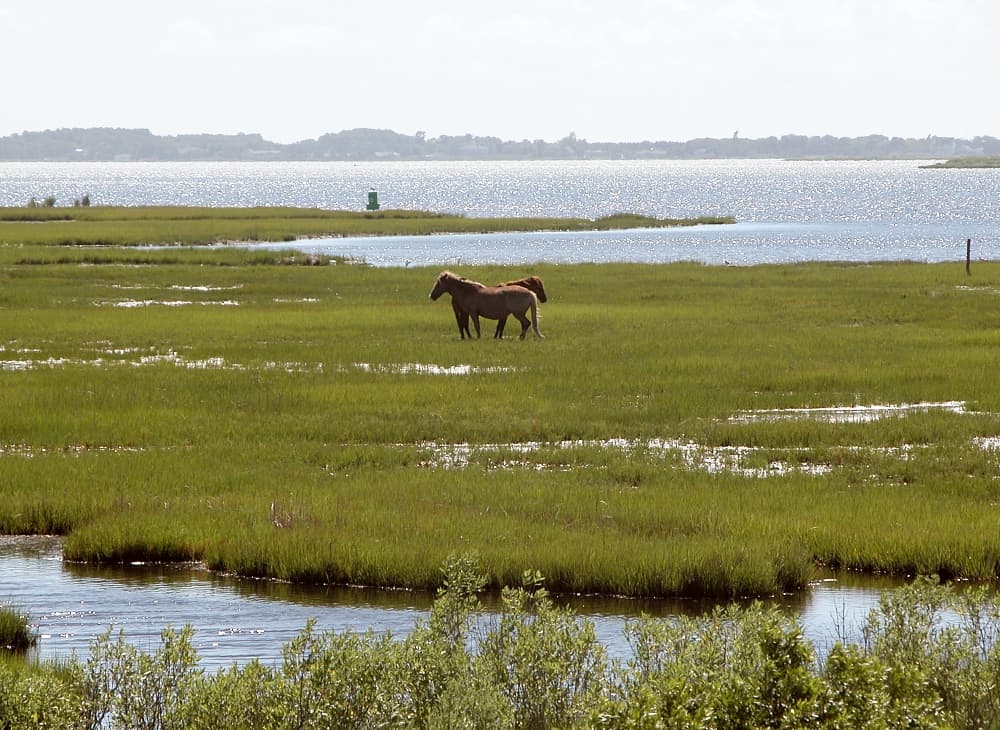
Wild ponies on an Atlantic barrier island, Chesapeake marsh, and a 53-foot waterfall in the western mountains, all within a few hours' drive.
Top parks in Maryland
See all 57 parksAssateague Island National Seashore
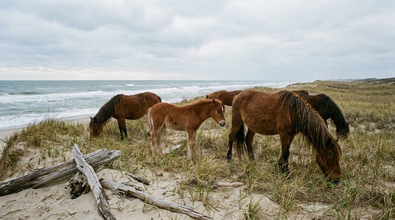
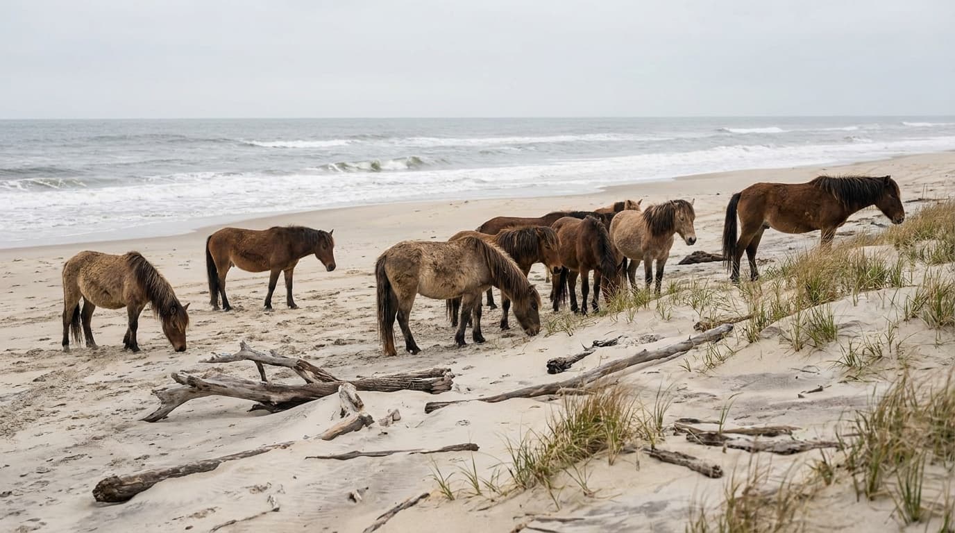
The barrier island famous for its wild horses, with NPS Oceanside and Bayside campgrounds on Recreation.gov, an over-sand vehicle zone, and miles of open Atlantic beach. This is the NPS seashore, distinct from neighboring Assateague State Park.
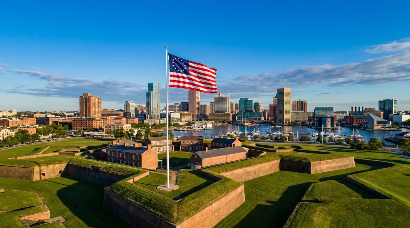
Fort McHenry National Monument and Historic Shrine
The star-shaped Baltimore fort whose defense in the 1814 Battle of Baltimore inspired Francis Scott Key to write the words that became the national anthem.
Assateague State Park
Maryland's only oceanfront state park, on a barrier island shared with wild horses, where ocean and bay sit two miles apart. Two miles of beach, marsh paddling, and a popular campground that books out a year ahead.
Patapsco Valley State Park
Maryland's sprawling river-valley park outside Baltimore: more than 16,000 acres along 32 miles of the Patapsco River, the popular Cascade Falls and the Orange Grove swinging bridge, over 200 miles of trail, and two campgrounds across multiple recreation areas.
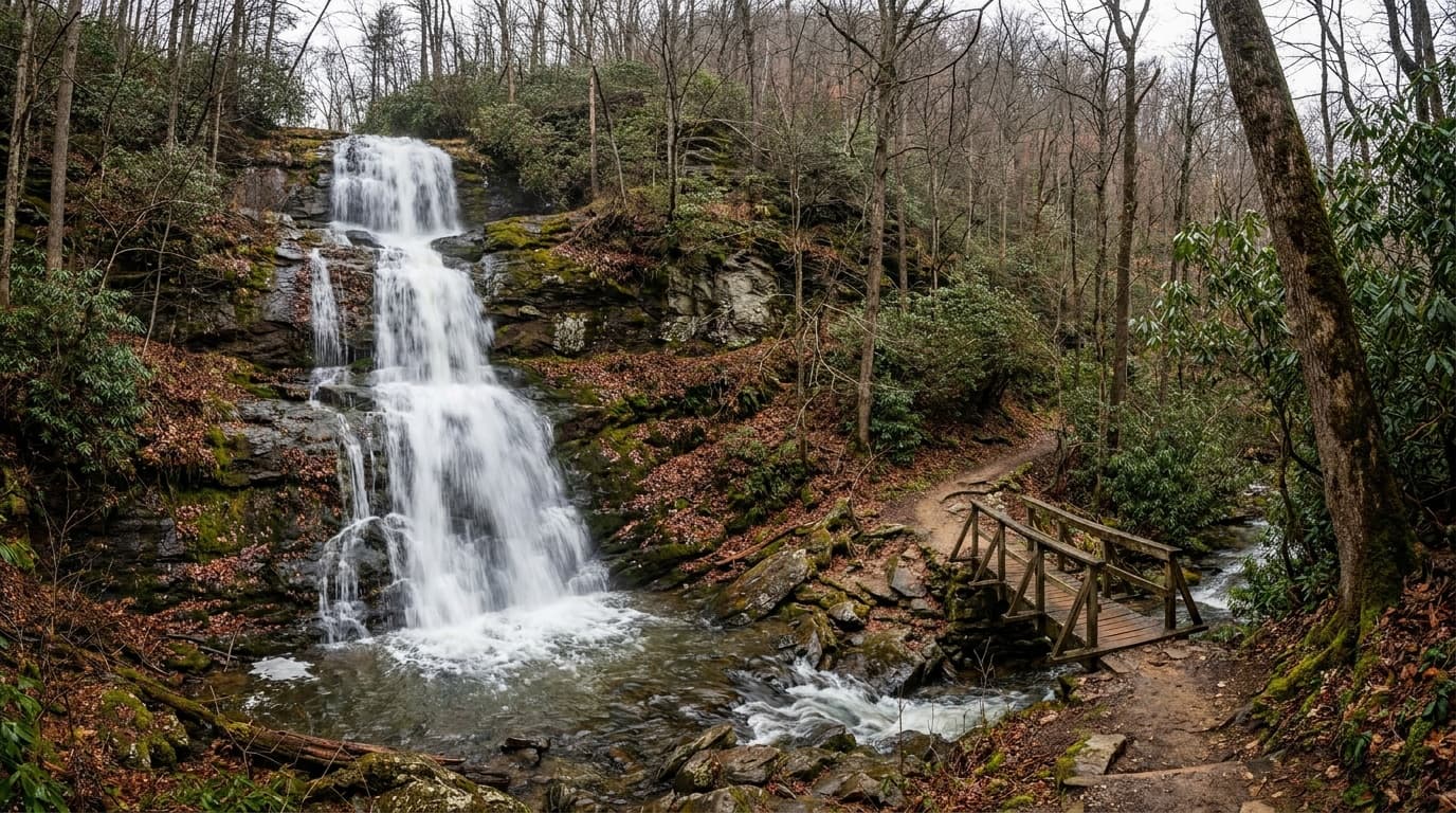
Swallow Falls State Park
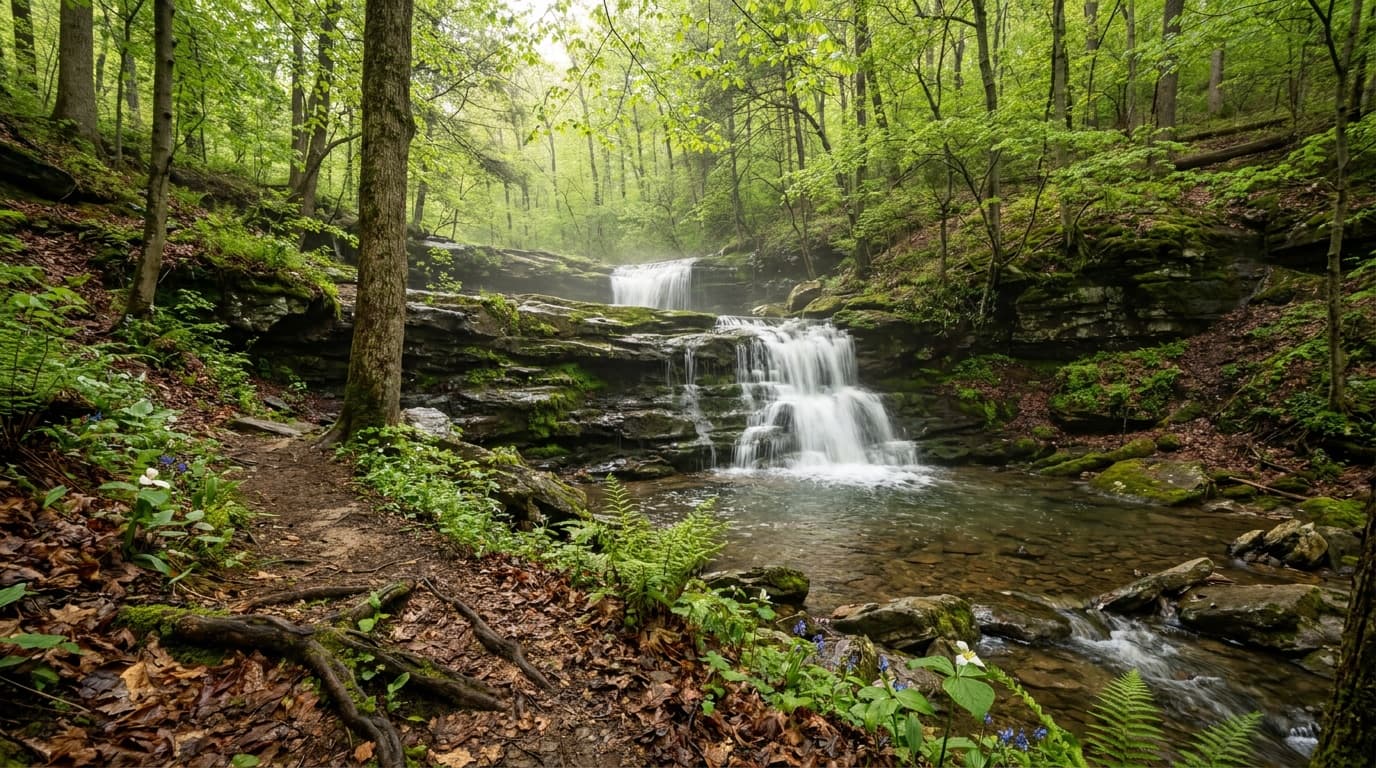
Maryland's waterfall showpiece in the western mountains: 53-foot Muddy Creek Falls, the Youghiogheny River gorge, old-growth hemlocks, the Canyon Loop Trail, and a wooded campground.
Appalachian Trail
The Appalachian Trail is a footpath across 2,168 miles of Appalachian Mountain ridgelines from Georgia to Maine, with almost 40 miles crossing Maryland.

Big Run State Park
Situated at the mouth of the Savage River Reservoir, Big Run State Park is a base camp from which to enjoy the surrounding Savage River State Forest.

Bill Burton Fishing Pier State Park
Bill Burton Fishing Pier State Park spans about 25 acres on either side of the Choptank River, with piers popular for the variety of fish that can be caught.
Bohemia River State Park
Bohemia River State Park offers passive recreation such as trail use and nature observation, with a small parking area and multi-use trails.
Planning a Maryland trip
Maryland packs a surprising range of outdoors into a small footprint. In the space of a single state you can stand on an Atlantic barrier island, paddle a Chesapeake tidal marsh, and hike to a mountain waterfall in old-growth hemlock. There is no national park here, so the state-park and state-forest system carries the load, and it carries it well.
Start at the coast. Assateague State Park sits on a barrier island where wild horses roam the dunes and the surf, and it is the headline experience most people picture when they think of Maryland outdoors. Camping there puts you on the beach with the ponies at dawn. Move inland to the Piedmont and Catoctin Mountain area for forested ridge hikes like Chimney Rock and Wolf Rock, with long views over the Monocacy Valley. Then head all the way west into Garrett County, the highlands, where Swallow Falls State Park holds Muddy Creek Falls (the state's tallest at 53 feet) inside one of the last stands of 360-year-old hemlock, and Deep Creek Lake anchors a four-season recreation area for paddling, boating, and fall color.
When to go depends on what you want. Late spring through early summer is ideal for the coast and the bay before the worst heat and humidity arrive. Summer highs commonly sit in the upper 80s F with sticky humidity, so plan water activities and early starts. Fall is the standout for the mountains: western Maryland peaks first, often by late September, with the rest of the state following into mid-to-late October when highs ease into the 60s F. Winters are mild on the coast but can bring real snow to Garrett County.
The packing through-line is range. You are dressing for sun, sand, and biting insects at the shore and for cool, damp forest at elevation, sometimes in the same trip. Bring sun protection, bug defense, and water for the lowlands, plus a warm layer and rain shell for the western highlands where it runs cooler year-round. Sturdy footwear handles both the rocky ridge trails and the muddy creek crossings near the falls.
Getting around Maryland
Most visitors fly into one of three nearby hubs. Baltimore/Washington (BWI) is the in-state airport and the most convenient base for the bay and the central parks. Washington Dulles (IAD) and Reagan National (DCA) just across the Potomac in Virginia are also practical, especially for the western mountains. From any of them you will want a car, because the best outdoor areas are spread to opposite corners of the state and transit between them is limited.
Distances are manageable but real. From the Baltimore-Washington corridor, the coast at Assateague is roughly 2.5 to 3 hours east via US-50 across the Chesapeake Bay Bridge. The Catoctin Mountain area near Thurmont is about 1 to 1.5 hours northwest. Going to the far western highlands is the long haul: Deep Creek Lake and Swallow Falls in Garrett County sit roughly 3 to 3.5 hours west of Baltimore via I-70 and I-68, climbing into the Appalachian Plateau.
A useful way to think about it: the state runs east to west like a long ribbon, and the two marquee experiences (coast and mountains) live at the far ends, around 5 to 6 hours apart if you drove the whole span. Plan a trip around one end rather than trying to do both in a weekend. The bay shore and Piedmont parks in the middle make easier day trips from the cities.
State park directory
Every Maryland state park
A source-backed inventory layer for planning breadth. Full Kit Authority guides are marked when a park has camping detail, rules, and packing notes; the rest link straight to the official page.
57 parks
3 full guides · 50 with photos
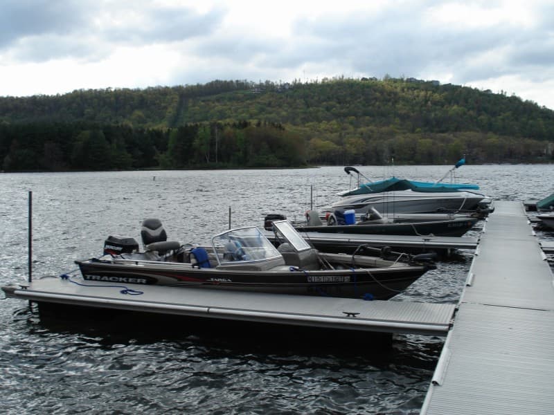
Assateague State Park
State Park
Assateague State Park is Maryland's only oceanfront park, located on a barrier island with two miles of ocean beaches and bayside coves to explore.
- Swimming
- Beach
- Fishing
- Paddling
Maryland Park Service
Full guidePatapsco Valley State Park
State Park
Patapsco Valley State Park extends along 32 miles of the Patapsco River, encompassing 16,043 acres and eight developed recreational areas.
- Hiking
- Fishing
- Camping
- Paddling
Maryland Park Service
Full guideSwallow Falls State Park
State Park
This mountain park north of Oakland contains breathtaking scenery along the Youghiogheny River, including the 53-foot Muddy Creek Falls and tall hemlocks.
- Camping
- Fishing
- Hiking
- Picnicking
Maryland Park Service
Full guideAppalachian Trail
State Trail
The Appalachian Trail is a footpath across 2,168 miles of Appalachian Mountain ridgelines from Georgia to Maine, with almost 40 miles crossing Maryland.
- Hiking
- Backpacking
- Wildlife Viewing
Maryland Park Service
Official pageBig Run State Park
State Park
Situated at the mouth of the Savage River Reservoir, Big Run State Park is a base camp from which to enjoy the surrounding Savage River State Forest.
- Fishing
- Boating
- Hiking
- Hunting
Maryland Park Service
Official pageBill Burton Fishing Pier State Park
State Park
Bill Burton Fishing Pier State Park spans about 25 acres on either side of the Choptank River, with piers popular for the variety of fish that can be caught.
- Fishing
- Picnicking
- Biking
- Wildlife Viewing
Maryland Park Service
Official pageBohemia River State Park
State Park
Bohemia River State Park offers passive recreation such as trail use and nature observation, with a small parking area and multi-use trails.
- Hiking
- Biking
- Wildlife Viewing
- Fishing
Maryland Park Service
Official pageCalvert Cliffs State Park
State Park
Calvert Cliffs State Park is a day-use park featuring a sandy beach, prehistoric fossils, a freshwater and tidal marshland, and 13 miles of hiking trails.
- Fishing
- Hiking
- Beach
Maryland Park Service
Official pageCasselman River Bridge State Park
State Park
Casselman River Bridge State Park is a 4-acre parcel centered on an 1813 stone arch bridge that once served as a link on the National Road.
- Picnicking
- Fishing
Maryland Park Service
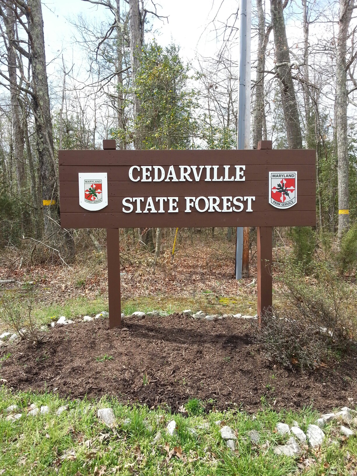
Official pageCedarville State Forest
State Forest
Located at the headwaters of Maryland's largest freshwater swamp, Cedarville State Forest spans 3,707 acres with over 19 miles of trails.
- Hiking
- Biking
- Horseback Riding
- Camping
Maryland Park Service
Official pageChapel Point State Park
State Park
Chapel Point is a 600-acre undeveloped multi-use park with waterfront on the Port Tobacco River, a tributary of the Potomac River.
- Fishing
- Boating
- Hunting
- Wildlife Viewing
Maryland Park Service
Official pageChapman State Park
State Park
Chapman State Park preserves mature forests, rare plants, and the historic Mt. Aventine Mansion, stretching from the Potomac River to Mattawoman Creek in western Charles County.
Maryland Park Service
Official pageCunningham Falls State Park
State Park
Cunningham Falls State Park sits in the Catoctin Mountains and is divided into the lake and falls William Houck Area and the Manor Area.
- Swimming
- Hiking
- Fishing
- Paddling
Maryland Park Service
Official pageDans Mountain State Park
State Park
Perched high on a mountain in Lonaconing, the 481-acre Dans Mountain State Park features an accessible swimming pool, group pavilions, a playground, and a fishing pond.
- Swimming
- Fishing
- Picnicking
- Playground
Maryland Park Service
Official pageDeep Creek Lake State Park
State Park
Deep Creek Lake State Park encompasses over 1,800 acres adjoining a 3,900-acre man-made lake, with two swimming beaches, 20 miles of trails, and a campground.
- Fishing
- Hunting
- Swimming
- Hiking
Maryland Park Service
Official pageElk Neck State Park
State Park
Elk Neck State Park spans 2,370 acres on a peninsula between the Chesapeake Bay and the Elk River, with marshlands, woods, white clay cliffs, and sandy shorelines.
- Hiking
- Swimming
- Paddling
- Picnicking
Maryland Park Service
Official pageFort Frederick State Park
State Park
Fort Frederick State Park centers on the only stone fort built by a British colony during the French and Indian War, on 585 acres bordering the Potomac River.
- Paddling
- Camping
- Hiking
- Picnicking
Maryland Park Service
Official pageGambrill State Park
State Park
Gambrill State Park sits on the ridge of the Catoctin Mountains in Frederick County, with 16 miles of trails and stone overlooks offering valley views.
- Hiking
- Biking
- Picnicking
- Fishing
Maryland Park Service
Official pageGathland State Park
State Park
Gathland State Park is a day-use park centered on a stone monument to Civil War correspondents, once the mountain home of journalist George Alfred Townsend.
- Hiking
- Historic Site
Maryland Park Service
Official pageGreenbrier State Park
State Park
Greenbrier State Park is a multi-use park in the Appalachian Mountains with a 42-acre man-made lake, sandy beach, almost eleven miles of trails, and 164 campsites.
- Swimming
- Paddling
- Boating
- Fishing
Maryland Park Service
Official pageGreenwell State Park
State Park
Greenwell is a 596-acre state park on the Patuxent River in St. Mary's County, managed in partnership with the Greenwell Foundation for accessible recreation.
- Picnicking
- Paddling
- Swimming
- Fishing
Maryland Park Service
Official pageGunpowder Falls State Park
State Park
Gunpowder Falls State Park covers over 18,000 acres in Harford and Baltimore Counties with more than 120 miles of multi-use trails and a swimming beach.
- Hiking
- Fishing
- Paddling
- Swimming
Maryland Park Service
Official pageHarriet Tubman Underground Railroad State Park
State Park
The 17-acre Harriet Tubman Underground Railroad State Park and Visitor Center features exhibits on Tubman's early years in Maryland and her legacy in the Underground Railroad.
- Historic Site
- Picnicking
- Nature Trails
Maryland Park Service
Official pageHart-Miller Island State Park
State Park
Hart-Miller Island is a 1,100-acre island in Baltimore County on the Chesapeake Bay, accessible by boat and known for its abundant migrating bird populations.
- Boating
- Swimming
- Beach
- Camping
Maryland Park Service
Official page


Show 33 more Maryland parks
Herrington Manor State Park
State Park
The 365-acre Herrington Manor State Park sits within Garrett State Forest around the 53-acre Herrington Lake, with 20 furnished log cabins for year-round rental.
- Swimming
- Paddling
- Biking
- Picnicking
Maryland Park Service
Official pageJanes Island State Park
State Park
Janes Island State Park near Crisfield offers a mainland campground and an island portion with over 2,900 acres of saltmarsh, 30 miles of water trails, and pristine beaches.
- Fishing
- Boating
- Paddling
- Hunting
Maryland Park Service
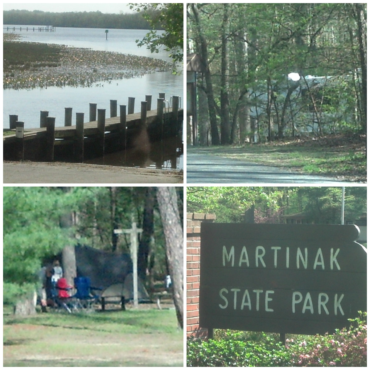
Official pageMartinak State Park
State Park
Martinak State Park is bordered by the Choptank River and Watts Creek, supporting varied plant and animal life with modern campsites and boating access.
- Fishing
- Boating
- Hiking
- Camping
Maryland Park Service
Official pageNew Germany State Park
State Park
New Germany State Park is a mountain park with diverse forests, ten miles of multi-use trails, and a small lake suitable for fishing, swimming, and paddling.
- Fishing
- Swimming
- Paddling
- Hiking
Maryland Park Service
Official pageNewtowne Neck State Park
State Park
Newtowne Neck State Park is a 794-acre peninsula surrounded by Breton Bay, St. Clements Bay, and the Potomac River, with seven miles of waterfront.
- Fishing
- Hunting
- Paddling
- Camping
Maryland Park Service
Official pageNorth Point State Park
State Park
North Point is a 1,310-acre park on the Chesapeake Bay in Edgemere, once the site of the Bay Shore Amusement Park, with two fishing piers and hiking trails.
- Hiking
- Biking
- Fishing
- Picnicking
Maryland Park Service
Official pagePalmer State Park
State Park
Two miles of scenic Deer Creek run through the 555-acre Palmer State Park, with historic sites along the creek banks and native flora and fauna in forested habitat.
- Hiking
- Paddling
- Fishing
- Historic Site
Maryland Park Service
Official pagePatuxent River State Park
State Park
Patuxent River State Park comprises 6,700 acres of natural areas and farmlands along the upper 12 miles of the river in Howard and Montgomery counties.
- Hunting
- Fishing
- Hiking
- Horseback Riding
Maryland Park Service
Official pagePocomoke River State Park
State Park
Pocomoke River State Park sits along the Pocomoke River and is home to the northernmost bald cypress swamp, a unique ecosystem with changing flora and fauna.
- Hiking
- Biking
- Fishing
- Wildlife Viewing
Maryland Park Service
Official pagePoint Lookout State Park
State Park
Point Lookout State Park sits on a peninsula between the Chesapeake Bay and the Potomac River, on the site of a Civil War camp that imprisoned Confederate soldiers.
- Camping
- Boating
- Fishing
- Hunting
Maryland Park Service
Official pageRocks State Park
State Park
Rocks State Park features 855 acres of rocky forest in northern Harford County, with attractions including the King and Queen Seat and Kilgore Falls.
- Picnicking
- Hiking
- Fishing
- Climbing
Maryland Park Service
Official pageRocky Gap State Park
State Park
Rocky Gap State Park encompasses over 3,000 acres in Allegany County around the 243-acre Lake Habeeb, fed by Rocky Gap Run through a mile-long gorge.
- Hiking
- Paddling
- Swimming
- Fishing
Maryland Park Service
Official pageRosaryville State Park
State Park
Rosaryville is a 1,227-acre day-use park with miles of trails for hiking, biking, and equestrians.
- Hiking
- Biking
- Horseback Riding
Maryland Park Service
Official pageSandy Point State Park
State Park
This 786-acre park lies along the northwestern shore of the Chesapeake Bay, known for scenic water views, beaches, and picnic areas.
- Fishing
- Picnicking
- Swimming
- Boating
Maryland Park Service
Official pageSang Run State Park
State Park
Sang Run State Park preserves an early 1800s homestead along the Wild and Scenic Youghiogheny River, with over 2.5 miles of trails through pollinator meadows.
- Hiking
- Fishing
- Picnicking
- Historic Site
Maryland Park Service
Official pageSeneca Creek State Park
State Park
Seneca Creek State Park comprises 6,300 acres along 14 miles of Seneca Creek, including the 90-acre Clopper Lake and over 50 miles of trails.
- Picnicking
- Boating
- Hiking
- Horseback Riding
Maryland Park Service
Official pageSmallwood State Park
State Park
Smallwood State Park is a 628-acre park named for General William Smallwood, with a marina, boat ramps, camping sites, nature trails, and the historic Smallwood's Retreat.
- Boating
- Fishing
- Camping
- Picnicking
Maryland Park Service
Official pageSouth Mountain State Park
State Park
South Mountain State Park is a 40-mile multi-use park along the South Mountain ridge, following the Appalachian Trail with scenic overlooks and Civil War history.
- Hiking
- Camping
- Backpacking
- Wildlife Viewing
Maryland Park Service
Official pageSt. Clement's Island State Park
State Park
This 43-acre park in the Potomac River off Colton's Point marks where the first English settlers under the Baltimore proprietorship landed in 1634.
- Hiking
- Picnicking
- Historic Site
Maryland Park Service
Official pageSt. Mary's River State Park
State Park
St. Mary's River State Park holds the 250-acre St. Mary's Lake, a popular freshwater fishing spot with a boat launch, picnic tables, and a playground.
- Fishing
- Boating
- Hunting
- Picnicking
Maryland Park Service
Official pageSusquehanna State Park
State Park
Susquehanna State Park sits along the Susquehanna River valley with popular mountain biking trails, fishing, a family-friendly campground, and the Rock Run Historic Area.
- Biking
- Fishing
- Boating
- Camping
Maryland Park Service
Official pageTorrey C. Brown Rail Trail
State Trail
The Torrey C. Brown Rail Trail follows 19.7 miles of the former Northern Central Railway in northern Baltimore County, passing through several historic communities.
- Hiking
- Biking
- Horseback Riding
Maryland Park Service
Official pageTuckahoe State Park
State Park
Tuckahoe Creek runs the length of this park bordered by wooded marshlands, with a 60-acre lake and 20 miles of scenic hiking, biking, and equestrian trails.
- Boating
- Fishing
- Hiking
- Biking
Maryland Park Service
Official pageWashington Monument State Park
State Park
Located atop South Mountain, Washington Monument State Park is named for the first completed monument to George Washington, a rugged stone tower erected in 1827.
- Hiking
- Picnicking
- Camping
- Historic Site
Maryland Park Service
Official pageWestern Maryland Rail Trail
State Trail
The Western Maryland Rail Trail is a paved, linear trail about 28 miles long that parallels the C&O Canal Towpath for its entire length.
- Hiking
- Biking
Maryland Park Service
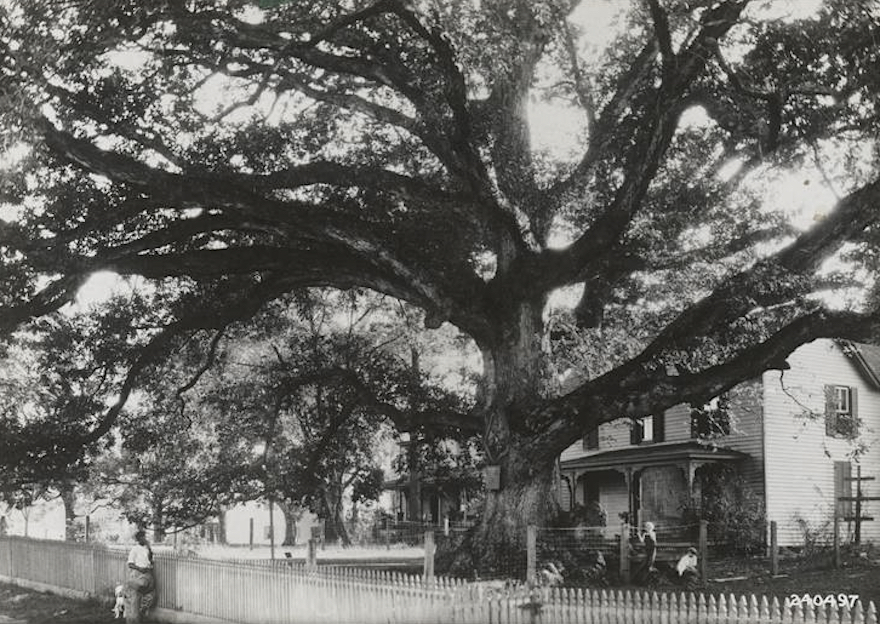
Official pageWye Oak State Park
State Park
Wye Oak State Park consists of 29 acres designed to protect the famed Wye Oak Tree, which toppled in 2002, alongside a colonial-era one-room schoolhouse.
- Picnicking
- Historic Site
Maryland Park Service
Official pageCypress Branch State Park
State Park
Cypress Branch State Park consists of 314 acres of cropland, meadows, forest, and marsh with a 3-acre freshwater pond, managed as a Natural Resource Management Area.
- Fishing
- Hiking
- Biking
- Picnicking
Maryland Park Service
Official pageDeep Creek Lake Natural Resource Management Area
State park system area
The Deep Creek Lake Natural Resource Management Area surrounds a lake created in 1925, with 65 miles of shoreline and a surface area of 3,900 acres.
- Boating
- Fishing
- Hiking
- Camping
Maryland Park Service
Official pageFind a State Park
State Park
Maryland Park Service
Official pageFranklin Point State Park
State Park
Franklin Point State Park is a 477-acre peninsula of marsh, forest, and field with sand shoreline overlooking the Chesapeake Bay in southern Anne Arundel County.
- Wildlife Viewing
- Hiking
- Paddling
Maryland Park Service
Official pageFreedman's State Park
State Park
Freedman's State Park is a 1,000-acre park telling the story of an African American family that overcame enslavement to become prosperous in northern Montgomery County.
- Hiking
- Historic Site
Maryland Park Service
Official pageSideling Hill Creek State Park
State Park
Sideling Hill Creek State Park is 514 acres of mountainous forest with a Potomac River overlook and a stocked trout stream, providing a haven for 30 rare species.
- Hiking
- Fishing
- Wildlife Viewing
- Picnicking
Maryland Park Service
Official pageWolf Den Run State Park
State Park
Wolf Den Run State Park is a 2,039-acre multi-use park with the largest collection of ORV trails in Maryland and three miles of access along the north branch of the Potomac River.
- Hiking
- Biking
- Fishing
- Wildlife Viewing
Maryland Park Service
Official page


Inventory source: USGS PAD-US 4.1. Photos are public-domain or Creative Commons via Wikimedia Commons, credited per image. Official reservations and rules remain state-specific, so use the state booking links before committing to dates.
Frequently asked questions
What is the best national park in Maryland?
Maryland does not have a designated national park within its borders. The outdoor scene is built around the state-park and state-forest system instead. The closest national-park-style experiences are Assateague (a barrier island shared with the National Seashore on the Virginia side) and the Catoctin Mountain area, plus the C&O Canal towpath that follows the Potomac.
When is the best time to visit Maryland's parks?
Fall is the standout, especially for the western mountains, where color peaks from late September in Garrett County into mid-to-late October elsewhere, with comfortable highs in the 60s F. Late spring and early summer are best for the coast and Chesapeake Bay before the heat and humidity of high summer set in, when highs reach the upper 80s F. Winters stay mild near the coast but bring real snow to the western highlands.
Where can you see the wild horses in Maryland?
The wild horses live on Assateague Island on the Atlantic coast, accessible through Assateague State Park and the adjoining national seashore. The herd roams freely across the dunes and beaches, so keep a safe distance and never feed them. Camping on the island gives you the best odds of seeing them at dawn and dusk.
What should I pack for outdoor trips in Maryland?
Pack for range, because a single trip can span hot, buggy coastal lowlands and cool, damp mountain forest. For the shore and bay, bring sun protection, insect defense, and plenty of water. For the western highlands, add a warm layer and a rain shell since it runs cooler and wetter year-round, and wear sturdy footwear that handles both rocky ridges and muddy creek crossings.